October brings us new books about sea-level rise, wolves and feeding the resistance.
October arrives with a chill in the air, a touch of color on the leaves, the promise of impending ghosts and ghouls… and a heck of a lot of new environmentally themed books.
Publishers must love fall as much as I do, because they have a ton of new titles scheduled for this month, including books on climate change, canines and food for your soul.
Here are five of our favorites being released during October:
After the past month of natural disasters, this book couldn’t be more perfectly timed — or more necessary. Goodell traveled across the globe to see how climate change and sea-level rise are affecting cities — and the people who live in them — in a dozen countries. He even visited one island nation that may not exist for much longer. This book covers the history of how we have adapted to changing sea levels as well as the science of what’s happening now and in the near future. A must-read. (Little, Brown and Company, October 24, $28)
If The Water Will Come gets you too depressed, here’s the flip side: Postel’s examination of water projects around the world that actually work. If safe drinking water, working watersheds, clean rivers and un-floodable cities matter to you, check this one out. (Island Press, October 10, $29)
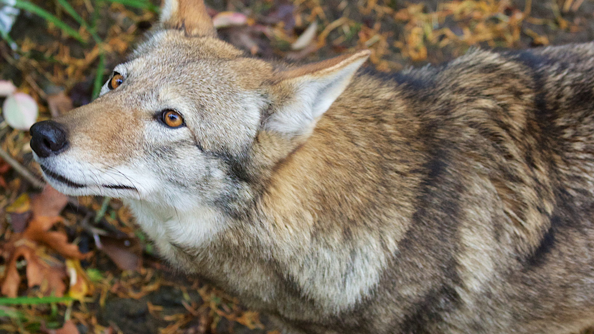
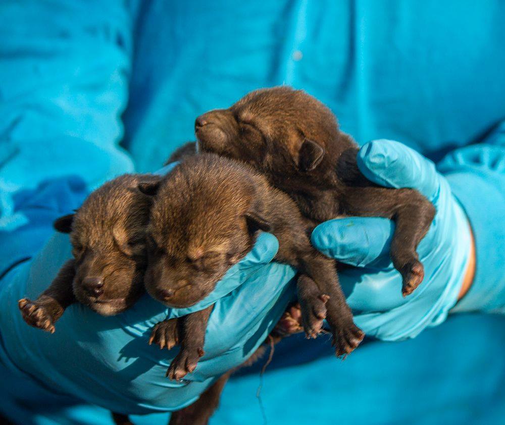
The true story of one wolf — Yellowstone’s fabled alpha female named O-Six — and her effect on people around the world. Some admired her. Others feared her and her kind. This is not a story that ends well, but Blakeslee tells it marvelously, in a way that will leave every reader thinking. (Crown, October 17, $28)
Sticking with canines, here’s a new graphic novel to help fill kids in on the genetics, evolution and adaptation of mankind’s best friend. Make sure to check out other books in this series, especially the ones on sharks and coral reefs. (First Second, October 31, $12.99)
They say an army marches on its stomach. If that’s true then the resistance to the current wave of regressive ideas had better be well-fed. Turshen provides a book full of recipes perfect for eating while gathering around to talk about civil rights, environmental justice and other tasty topics. She also provides the ingredients on how to get started in the worlds of “food, politics and social causes.” (Chronicle Books, October 3, $14.95)
That’s our list for October, but we know there’s a lot more out there. What are you reading? Share your favorite new or old environmental books in the comments below.
Oil surveys in the Atlantic Ocean could harm marine life without benefiting the US economy.
WASHINGTON— Few days go by without President Trump touting his “America First” agenda, which includes his ambitions to dramatically ramp up offshore drilling for oil and natural gas.
There’s some irony, then, that the first beneficiaries of these initiatives could be mostly foreign-based companies that stand to reap millions of dollars in revenue from conducting oil and gas seismic surveys in the waters off the East Coast.
An investigation by The Revelator reveals that four of these seismic survey companies are based overseas. Only one is based in the United States. The surveys are highly speculative ventures, to be conducted in a region thought to hold relatively low oil and gas reserves and appear unlikely to proceed without significant upfront funding from oil companies.
Our investigation also shows that despite decades of research on the impact of noise on marine mammals and other wildlife, there has never been a robust, ecosystem-wide examination of its effects. This gap in the understanding of regional impacts of seismic surveys on an array of marine life is contributing to ongoing debate within the marine science community on their impacts on oceanic species.
The oil and gas industry and the federally funded National Science Foundation, along with Columbia University’s prestigious Lamont-Doherty Earth Observatory, say the seismic testing causes no lasting harm to marine life. But other marine biologists and environmentalists say there is increasing evidence showing that the surveys do cause significant harm and therefore should not be conducted in the Atlantic.
“The (industry) claims there is no demonstrated effect,” says Douglas Nowacek, associate professor of conservation technology at Duke University Marine Laboratory in Beaufort, North Carolina. “But nobody has looked” thoroughly enough.
Opening up the Atlantic to Oil and Gas
The National Marine Fisheries Service is currently reviewing the applications to conduct seismic surveys spanning 330,000 square miles of the Atlantic between New Jersey and Florida.
Trump issued an executive order this past April to open the mid- and south-Atlantic to potential oil and gas development. The order also directed the fisheries service to “expedite all stages” of seismic survey applications. Decisions on whether to proceed with oil and gas leasing in the Atlantic and to award seismic survey permits are expected later this year.
Seismic surveys use super-loud underwater blasts from powerful air guns to map the ocean floor in search of fossil fuels. The surveys are a crucial first step in determining whether there are sufficient oil and natural gas for energy companies to invest billions of dollars to develop offshore production platforms and onshore processing facilities. The sounds are roughly equivalent to a grenade blast and can be detected thousands of miles across the ocean.
The Trump administration’s plan to open the Atlantic for oil and gas exploration offers one of the largest seismic testing opportunities in the world. Offshore seismic surveys are conducted on a regular basis across the globe.
Applications to conduct these surveys have been submitted by Spectrum Geo and TGS, both headquartered in Norway; the French company CGG; and WesternGeco, a subsidiary of oil services giant Schlumberger that’s incorporated in the Caribbean island nation of Curaçao and has offices in Houston. The smallest of the five companies is Houston-based Ion Geophysical Corp.
Seismic survey cruises are generally required to have certified marine wildlife lookouts on watch and typically use “passive acoustic monitoring” systems to listen for marine mammal vocalizations. Seismic survey testing is stopped if marine mammals are detected nearby. But the monitoring is far from foolproof.
Conservation experts argue that more mitigation is needed to reduce the potential impacts of these studies that could harm not just wildlife but other industries, including commercial and sport fishing.
“Approving seismic blasting in the Atlantic would simply shift the conservation burden [for marine species] onto U.S. fisheries and others in this country, to profit what are mostly foreign companies,” Michael Jansy, director of the Natural Resources Defense Council’s Marine Mammal Protection Project, tells The Revelator.
Seismic Survey Industry Struggles to Stay Afloat
The Atlantic seismic surveys would come at a crucial time for the seismic survey industry, which has been battered by three years of low oil prices. The industry suffers from overcapacity, bankruptcies, layoffs, declining stock prices and years of financial losses that have slashed its market by 60 percent since 2012, according to the trade publication E&P Hart Energy.
Trump’s support of this industry also comes at a time when the United States is approaching record domestic oil production, with surging exports lead by steady productivity increases from fracking in the West Texas Permian basin, according to the U.S. Energy Information Administration.
Atlantic reserves, by comparison, aren’t necessarily attractive to oil companies. Pavel Molchanov, senior vice president and equity research analyst at Raymond James & Associates Inc., told E&E News in July that the Atlantic leases are unlikely to spur major new activity. “Industry does not want to drill in those places right now because prices are relatively weak,” he said.
It also seems unlikely that the debt-laden seismic survey companies will proceed with the very expensive surveys unless they receive some upfront prefunding from oil companies willing to purchase the survey data, The Revelator’s review of the five companies’ public financial reports show.
At least one of the companies confirms this to be true. “If we have customer support, we will move forward with a seismic data acquisition program,” Susan Ganz, a spokeswoman for WesternGeco, stated in an email to The Revelator.
How Much Oil Are We Talking About?
Seismic surveys taken in the Atlantic between 1966 and 1988 indicate approximately 2.8 billion barrels of technically recoverable oil reserves exist, mostly in the mid-Atlantic. Only 2.4 billion barrels are considered economically recoverable at $100/barrel, nearly double the current price, according to a 2016 Bureau of Ocean Energy Management report. That’s just enough oil to meet current U.S. demand for about 120 days.
The industry is hopeful that these old estimates are incomplete. “Atlantic seismic survey data are needed to update resource estimates that are based on decades-old information,” a consortium of oil industry trade groups stated in an Aug. 17 filing to the Bureau of Ocean Energy Management. “With new seismic data in hand, decisions informed by science can be made as to the true resource potential in these areas.”
The current proposed round of Atlantic seismic applications calls for two-dimensional (2D) testing. But if new prospects are discovered, additional seismic surveys using more advanced 3D and 4D technologies could be conducted, providing a four-dimensional view of the ocean floor, industry experts say.
Environmental groups question why it’s necessary to issue Atlantic seismic permits to all five companies, which will conduct surveys in overlapping areas and in some cases, at the same time. The companies will pay nothing to the federal government for the potential harm that could result to marine life.
To minimize the impact on species, environmentalists urge the sharing of survey data from a single company rather than allowing multiple companies to acquire data that would then be subsequently sold to oil and gas companies.
“Under the law, cumulative impacts (from seismic surveys) are not taken into account,” says Ingrid Biedron, a marine scientist with Oceana, an environmental group working to protect the world’s oceans.
A Seismic Split in the Science Community
Offshore seismic surveys use a series of air guns clustered in arrays and dragged underwater behind survey ships. The guns release compressed every 10 to 12 seconds, creating a sonic wave.
The testing continues 24 hours a day for months a time. The sound can travel several thousand miles through the ocean depending on water temperature, salinity and the ocean floor contour.
The sound waves are generally directed downward and bounce off subsurface geological formations. Hydrophones dragged behind the ship then receive the reflected sound. Sophisticated computer programs use the data to generate maps of the ocean floor, showing where potential oil and gas reserves may be located.
How does all this affect marine life? That’s still a matter of controversy.
The government previously considered the impact on marine life as potentially consequential. President Obama last December permanently withdrew the north- and mid-Atlantic from offshore oil and gas development because of the high potential for environmental damage and low amount of estimated hydrocarbon resources. Trump’s April executive order partially reverses that decision.
Before that, in the wake of Obama’s decision, the Bureau of Ocean Energy Management canceled six seismic survey applications. The agency’s then-director Abigail Ross Hopper stated this past January that the value of the potential information from “new air gun seismic surveys in the Atlantic does not outweigh the potential risks of those surveys’ acoustic pulse impacts on marine life.”
Oil-industry trade groups disagreed and stated in public comments filed in July with the National Marine Fisheries Service that “there has been no demonstration of any biologically significant negative impacts to marine life” from seismic surveys and that the proposed Atlantic surveys “will have no more than a negligible impact on marine mammal species” or on fisheries.
The oil industry’s contention that seismic testing causes negligible impact on marine life is supported by the National Science Foundation’s Division of Ocean Sciences. The science foundation owns the seismic survey research ship Marcus G. Langseth, operated by Columbia University’s Lamont-Doherty Earth Observatory’s Office of Marine Operations. The foundation provides about $10 million a year for offshore seismic survey research conducted by academic scientists across the country using the Langseth.
The Langseth serves as the national seismic research facility for the U.S. academic research community. The ship’s seismic research “provides a view of the Earth’s interior that is unmatched in clarity, quality, and detail by any other method,” a brochure issued by the Lamont-Doherty observatory states. “As a result, a wide array of key Earth processes can now be studied in all three dimensions.”
The National Science Foundation and the observatory have repeatedly stated in seismic survey applications to the National Marine Fisheries Service that the tests do not cause lasting harm to marine life, a position the federal regulatory agency has generally echoed.
In an October 2015 draft environmental analysis for a proposed seismic survey in the south Atlantic, the observatory’s environmental consultant concluded that the 42-day survey using an array of 36 air guns with total discharge of 6,600 cubic inches would have little impact on marine mammals. The size of that air gun array is comparable to the ones used by the five companies seeking Atlantic permits.
“It is unlikely that the proposed survey would result in any cases of temporary or permanent hearing impairment, or any significant non-auditory physical or physiological effects,” stated the observatory report, which was prepared by an Ontario-based environmental research firm called LGL Ltd. “If marine mammals encounter the survey while it is underway, some behavioral disturbance could result, but this would be localized and short-term.”
The National Marine Fisheries Service published a comprehensive assessment of seismic surveys on marine life in April 2016. The report was in response to a request for a permit to conduct a 60-day seismic survey in the south Pacific.
The fisheries service “does not anticipate that serious injury or mortality would occur as a result of Lamont-Doherty’s proposed seismic survey in the southeast Pacific Ocean,” the report stated.
“Lamont-Doherty’s proposed activities are not likely to cause long-term behavioral disturbance, serious injury, or death, or other effects that would be expected to adversely affect reproduction or survival of any individuals.”
Mounting Evidence of Significant Impact
But ongoing scientific research — often conducted in controlled settings — is compiling an increasing body of evidence that seismic surveys have negative impacts on marine life, with a chorus of scientists issuing dire warnings.
“Opening the U.S. east coast to seismic air gun exploration poses an unacceptable risk of serious harm to marine life at the species and population levels, the full extent of which will not be understood until long after the harm occurs,” 75 marine biologists stated in a 2015 letter sent to President Obama.
Researchers in Australia announced earlier this year they found that the seismic blasts killed zooplankton, raising concerns about the impact on the basic component of the ocean nutrient cycle.
On a larger scale, the endangered North Atlantic right whale (Eubalaena glacialis) is known to be sensitive to seismic generated noise and marine scientists fear any impact on its behavior — from decreased foraging to reproduction declines — could plunge the species toward extinction. The species experienced a spike of deaths reported earlier this year, primarily from entanglements with fishing gear, pushing the population below 500 whales.
The International Whaling Commission scientific committee concluded in 2005 that seismic surveys can cause “population level impacts.” The Convention on Biological Diversity stated in 2012 “there are increasing concerns about the long-term and cumulative of noise on marine biodiversity.”
A 2013 review on the impact of seismic air gun surveys on marine life found that “seismic air guns are the second highest contributor of human caused underwater noise in total energy output per year, following nuclear and other explosions.”
For years the government resisted even conducting significant studies on the possible impact of seismic surveys on marine mammals. It was only after environmental groups, including the Center for Biological Diversity, publishers of The Revelator, sued federal agencies that an Environmental Impact Statement on the impacts of seismic testing in the Gulf of Mexico was conducted.
That study clearly shows there are impacts. And in some cases, the study found, they can be severe. But the research was far from definitive and relied heavily on underwater robots to measure sound impacts. But the impact is harder to measure for marine mammals, which often have the ability to move away from loud sound sources, making it difficult to draw definitive conclusions.
Still, the report estimated that 31.9 million marine mammals in the Gulf of Mexico could be “moderately” harassed by oil and gas seismic surveys over 10 years. That includes 8 out every 10 members of the Gulf’s endangered sperm whale population.
The report concluded, however, that “the best available information, while providing evidence for concern and a basis for continuing research, does not, at this time, provide grounds to conclude that these surveys would disrupt behavioral patterns with more than negligible population-level impacts” (chapter 4-57).
The Gulf of Mexico has been routinely subjected to seismic surveys for decades but without a comprehensive examination of its impacts in marine life.
“Nobody has studied whether seismic on the scale of the Gulf of Mexico impacts the populations of marine mammals, turtles, fish, whatever,” says Nowacek, who is among the world’s leading scientists studying the impact of sound on marine life and has testified before Congress.
Burden of Proof
The lack of definitive information on the impacts of seismic surveys on marine life has given industry an advantage when it comes to obtaining permission from the National Marine Fisheries Services to issue Incidental Harassment Authorization permits to conduct the surveys, experts say.
The permits allow seismic survey companies to “incidentally but not intentionally harass marine mammals.” The agency typically issues the permits with stipulations that “prescribe monitoring, reporting, and mitigation measures to minimize the impacts of the surveys to marine mammals.”
Marine scientists opposed to seismic testing say the industry and National Science Foundation’s position that seismic surveys cause no lasting damage to marine life is based on a faulty premise.
Nowacek says the standards should be revised by requiring applicants to prove that the testing causes no serious harm to marine life, rather than forcing environmental groups and university marine biologists with limited funding to conduct decades of research that, while showing negative impacts on individuals, remain inconclusive on an ecosystem level.
“You have some tool, some technique of sampling, and it’s a good tool for what it does,” Nowacek says. “But why is the burden of proof that somebody has to show that there is a severe negative impact instead of the other way around? We should be having a discussion about where the burden of proof lies.”
That discussion is not currently part of the seismic testing application process in the mid-Atlantic, nor is it expected to be.
Over the last few days, I’ve been glued to social media, the phone, and ham radio-like apps trying to find out more about the fate of family members in the catastrophic situation in my native Puerto Rico following Hurricane María. (Fortunately, I was able to confirm on Friday that everyone in my immediate family is accounted for and safe). My family is among the few lucky ones. My childhood home is a cement suburban dwelling built on well-drained hilly soils, some eight kilometers from the coast, and well outside flood zones. But many of my 3.4 million co-nationals in Puerto Rico have not been so lucky, and are experiencing, as I write this, catastrophic flooding.
Puerto Rico remains completely dark and silent following Irma’s assault, having lost 100 percent of its electricity, hampering communications and complicating recovery efforts. Additionally, many residents are without access to clean drinking water, some are in areas that have not yet been aided by rescuers, and supplies are dwindling. In addition, there are more than 170,00 affected in the nearby US Virgin Islands and Dominica, Caribbean islands who have also experienced catastrophic damages.
The flood waters also continue to rage. Just in the largest suburban community in Puerto Rico — Levittown in the north — hundreds had to be evacuated on short notice during the early Thursday dawn as the gates of the Lago La Plata reservoir were opened and the alarm sirens failed to warn the population. The next day, a truly dramatic emergency evacuation operation followed as the Guajataca Dam in the northwest broke and 70,000 were urged to leave the area. At least ten have been confirmed dead so far.
The government of the Commonwealth has mounted a commendable response, but has been hampered in large part by the lack of power and communications facilities, which are inoperable at the moment except for those persons, agencies, and telephone companies that have power generators and the gas to keep them running. This has been one of the main impediments for Puerto Ricans abroad to communicate with loved ones and for the Rosselló administration’s efforts to establish communications and coordination with many towns that remain unaccounted for.
Puerto Ricans are also fearful of being left behind or forgotten. While the U.S. media coverage for storms Harvey and and Irma was robust, the same level of coverage has not been seen for Hurricane María. If this out-of-sight, out-of-mind mentality were to spread to the federal government, whose help is so desperately needed, it could prove monumentally disastrous for the island.
Underinvestment and neglect of infrastructure increases vulnerability to extreme weather
Why has Puerto Rico’s energy infrastructure been rendered so vulnerable in the recent weeks? The ferocity of Irma and María could stretch the capacity of even well-funded and maintained energy production and distribution systems. In Florida—where the power grid had received billions in upgrades over the last decade—Irma left two-thirds of the population without power (but was also able to bounce back after a few weeks).
But years of severe infrastructure underinvestment by the Puerto Rico Electric Power Authority (PREPA) has led to a fragile system that has completely collapsed after these two hurricanes. Irma’s indirect hit damaged distribution lines but not production; María’s eye made landfall on the southeast and exited through the central north, placing it right on the path of four of the high-capacity plants that burn heavy fuel and diesel oil. These plants are also located close to, or within, flood zones.
The reconstruction of the power infrastructure in Puerto Rico is a monumental task as it is critical to guarantee the well-being of Puerto Ricans. More than 3.4 million US citizens are now in a life-threatening situation and getting electricity up and running in the near term is critically important as it can support rescue and recovery efforts.
Wherever possible, these immediate efforts should aim to align with a broader rebuilding mission that points Puerto Rico toward a more economically robust and climate resilient future, not repairs that repeat the mistakes of the past. There is a need also to build resilience against the climate and extreme weather vulnerability Puerto Rico is so brutally facing right now.
While there is quite a bit of clean energy momentum in the United States, that impetus is not being transferred to Puerto Rico. There are many reasons for that, including lack of support from PREPA. But Puerto Rico has strong solar and wind energy resource potential, and renewable energy has been proposed as a way to help PREPA pare down its $9 billion dollar debt, help reduce reliance on fossil fuels and fossil fuel price volatility, lower costs to consumers, and contribute to an economic recovery for the Commonwealth.
This unprecedented catastrophe affecting millions of US citizens requires the intervention of the federal government
To ensure a safe and just economic recovery for Puerto Rico, Congress and the administration need to commit resources to help the territory recover. President Trump has declared Puerto Rico a disaster zone, and FEMA director Brock Long will visit the island on Monday. The priority right now is to save lives and restore basic services. To aid these efforts, Congress and the Trump administration should:
Direct the Department of Defense to provide helicopters and other emergency and rescue resources to Puerto Rico.
Provide an emergency spending package to the US territory.
Increase the FEMA funding level for debris removal and emergency protective measures in Puerto Rico.
Temporarily suspend the Jones Act. The Jones Act, which mandates that all vessels carrying cargo into the US and its territories be US Merchant Marine vessels, significantly increases the cost of importing goods into the island.
Once the state of emergency ends, Governor Rosselló needs to be very vocal that Puerto Rico’s energy infrastructure reconstruction should help put the Puerto Rican people and economy on a path to prosperity and resilience from climate impacts. The 2017 hurricane season is not over yet, and the situation in Puerto Rico right now is catastrophic. Decisions about energy infrastructure will be made in the coming days, weeks, and months. Those decisions need to take into account the short- as well as the long-term needs of the Puerto Rican population and help make Puerto Rico more resilient to the massive climate and weather extreme dislocations that we are facing.
Until recently, the dirty water the 81-year-old satirist used to clean his paint brushes each day would get dumped down the sink, never to be seen again.
But last year Steadman started pouring his water glasses onto something else: large pieces of paper on his studio floor. After the dirty water has dried for a day or two, he examines the faint colors and patterns — like a giant Rorschach inkblot — and an image forms in his mind. His paintbrushes come out again and he swirls and splats color and ink until the portrait of an endangered animal emerges.
“Picasso had his blue period,” he tells me. “I’ve entered my dirty-water period.”
The resulting paintings — 100 of them — can be found in the new book Critical Critters, published Sept. 26 by Bloomsbury, with proceeds from each sale benefitting the World Wildlife Fund.
The watery book marks Steadman’s third collaboration with writer, filmmaker and conservationist Ceri Levy. “That’s us,” Levy says. “A team built out of filth.”
The book is packed with portraits of endangered animals — giant pandas, tigers, chimpanzees, vaquitas, pangolins and dozens of other species — all depicted in the wild, paint-splattered technique Steadman made famous through his collaborations with gonzo journalist Hunter S. Thompson. Next to each painting, Levy provides text (both scientific and comic) about the various species. Alongside that information he contributes a running narrative about the process the duo used to develop the book and its contents.
That process involves Steadman and Levy trading a constant barrage of jokes, insults, barbs, slings, snipes and burns, along with the more-than-occasional pun.
“I guess that’s why we work well together,” Steadman laughs, “because we enjoy the hurt.”
The duo first teamed up a little over six years ago, when Levy asked Steadman to provide a single painting for an art exhibition about extinction. Steadman produced dozens. That led to their first book, Extinct Boids (2012), which contained portraits of bird species that are no longer with us. They followed it in 2015 with Nextinction, about the bird species that could be next to fall into extinction if the world doesn’t take action. Now they’ve finished the series by turning their pens and keyboard to the rest of the animal kingdom, tackling mammals, reptiles, fish, insects and even a plant or two.
(There are still a couple of birds in the new book. Steadman likes drawing beaks.)
Despite the heady topics of endangered species and extinction, Critical Critters — like the two books before it — is remarkably funny while remaining deeply informative. “We’ve always maintained that you’ve got to make people laugh in order to engage them,” Levy says. “If we just tell people, ‘you’re all dreadful bastards, you’ve screwed it all up, and now look what’s going to happen,’ people go, ‘yeah, whatever.’ But if you make them laugh, you’ve got a chance.
“That’s all you’re trying to do is inform people,” he continues. “But you’re trying to bribe them by giving them a good joke or two. And then they come to the table.”
Both creators say they feel they’ve accomplished something over the course of their collaboration and friendship. “Three hundred paintings down the line and we’re still talking to each other,” Levy says. “The weird thing is that one painting has now turned into a trilogy. We’re calling it the ‘gonzovation’ trilogy.”
“He stole that word off of me,” Steadman accuses gruffly, as the three of us talk over Skype.
Levy sighs, exasperated. “As soon as he’s in public, he says I’ve stolen everything.”
“Ceri just causes trouble,” growls Steadman. “He’s a bit like one of these critters. He creeps about and smashes things and then he eats somebody’s sandwich.”
Even with the book done, the two still trade their fair share of barbs.
So — what exactly is “gonzovation?” Levy says a gonzovationist is just an alternative conservationist. “I think it means the normal, regular people who are trying to help the world of conservation in some way,” he explains. “Everyone can do something to help animals, creatures, the planet, nature, and we don’t have to have, you know, university degrees. We can partake in conversation.”
Steadman interrupts. “What do you mean we don’t have university degrees?”
“Yours isn’t real! Did you show up for the tests?”
“I’m a BSc,” says Steadman, mock-indignant.
“I know what the BS stands for.”
“Bloody silly.”
“Gonzovation,” Levy finally continues, “allows the rest of us who aren’t in those hallowed halls of conservation to have a chance to do something. That’s the important thing. I think everyone’s fed up with clicking the ‘like’ button on Facebook or donating three dollars a month to help this or that animal. We need to find a way to participate and be hands-on.”
Both say working on the trilogy has opened their eyes. “I’ve learned an awful lot,” Levy says. “I had no idea when we started just how screwed the planet is at the moment and how many people are trying to screw with it. We’ve all got to do something. We can’t do nothing anymore. It could mean taking out the recycling. It could mean planting a tree that butterflies like. It could mean getting really good pollinating plants. We can all do things that help.”
Steadman says he’s stunned to find out why some of these species are endangered. “One of the things that amazes me, is that people have a need to go out hunting still.”
Even with three books under their belts, Levy feels there are still important things to learn, not just for himself but for the entire conservation community. “Conservation needs to find a way to get more people to do things that will help,” he says. “We need to engage. We need to find a way to make people feel they’re part of it, so they’re not disassociated from conservation projects. That’s the million-dollar question for conservationists today: how do we make people gonzovationists?”
The process that led to the creation of Critical Critters may hold part of that answer: “It’s just teamwork,” says Steadman. That’s what works in conservation — only maybe with fewer puns and snipes.
Beach cleanup efforts in Thailand illustrate the global problem of plastic pollution.
U.K. expat Rich Cramp and I sat in white plastic chairs on Nai Yang Beach in Phuket, Thailand, one afternoon this past June. With the sea behind us, plates of pad thai and Leo beer in front of us, we chatted about his involvement as a local organizer with Trash Hero, a Thailand-born, but now global, conservation nonprofit. He said the organization’s goal is to educate people about plastic pollution and get volunteers to clean up beaches, especially in places like Thailand where awareness of plastic pollution and its implications is low.
“It is a huge cultural taboo in Thailand to clean up other people’s trash,” said Cramp. “So much of what gets onto the ground stays on the ground or blows into freshwater sources or the ocean.”
In Thailand — the world’s sixth-greatest plastic polluter — and many other developing countries in Asia, socioeconomically disadvantaged people are delegated to clean up trash. So, Cramp explained, while Thais will clean up trash on their own properties, they tend to avoid cleaning other people’s trash in public places to avoid being seen by others as “lower class.”
This cultural taboo has lead to a huge accumulation of plastic trash in Thailand’s forests, lagoons, roadsides and beaches.
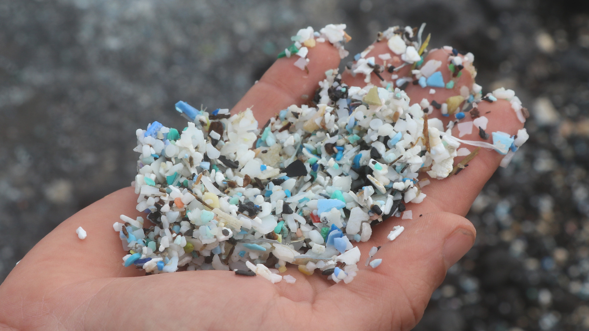
While exploring the country’s urban and natural places, I found that most of the litter on the ground was single-use plastic items like food wrappers and disposable eating utensils. But I also came across unwanted plastic-heavy items with more long-term use, like dishwashers and microwave ovens, washed up on beaches after being tossed into the sea. I saw huge amounts of microplastic — colorful plastic bits broken down from larger items —on beaches, and yards of frayed synthetic rope and fishing line wrapped around mangrove roots.
That’s consistent with the latest global data on plastic production, consumption and disposal. According to some of the world’s foremost plastic experts, 42 percent of all plastic not used to make clothing is used to manufacture packaging for consumer products. The second-biggest user of nonfiber plastic is the building and construction sector, followed by consumer products, industrial machinery, electronics and transportation, among other uses. About 8.3 billion metric tons of virgin plastic has been produced since the 1950s, with 6.3 billion metric tons of all that plastic discarded after use, most of which ends up in landfills and the environment. Only a small fraction gets recycled.
Cramp, in agreement with other cleanup organizers and scientists I’ve spoken to, said that the key to reducing the amount of plastic that ends up in the natural environment is to stop producing so much of it. But as we sat there on the beach, he also said events like beach cleanups can have a positive effect on the planet.
“When people get involved, they see the problem and learn more about it,” said Cramp. “They may feel empowered to buy less plastic and take care not to litter. Or they may feel compelled themselves to pick up the litter they see.”
Yet in Thailand, where there’s a huge amount of plastic to tackle, native Thais tend to be reluctant to join the cleanups for cultural reasons — which means many of his volunteers are expats like him.
Beach cleanup organizer Krix Luther, another U.K. expat who founded his own Thailand-based beach-cleanup nonprofit called Clean the Beach Bootcamp in May 2013, said he has the same issues as Cramp. Still, he’s optimistic about where things are heading. It seems that a growing number of Thais, especially young people, have the awareness and desire to take good care of their home environment.
“While most of my volunteers are expats and tourists, as well as teachers and their students, I do see a growing number of Thai volunteers,” said Luther, who holds a free fitness boot camp for people of all ages before his weekly cleanups. “Many are young people in their thirties, twenties and even teens. The beauty of a beach cleanup is that it’s so easy, anyone at any age can get involved and make a difference.”
I attended one of Luther’s Clean the Beach Bootcamps at Nai Harn Beach. There participants completed an hour-long beach workout led by Luther. About 50 participants — men and women; seniors, adults, teens and children; intense athletes and everyday people — ran and crawled across the beach’s soft sand and splashed through its turquoise-blue water. After a beach yoga cool-down, they spent an hour working together to pick up trash off the beach, stuffing about 660 pounds of trash into black garbage bags. Luther and a few volunteers also installed two bamboo garbage receptacles on the beach, which he said he hopes will encourage people to responsibly dispose of their trash, rather than leaving it on the beach.
Among the participants that day was Emanuele Mario Montalde, an 18-year-old Thai man who had just graduated high school. Montalde, who said he wants to pursue a career in environmental conservation, told me part of the reason for Thais’ reluctance to clean up trash is that in the past, it wasn’t as much of a problem.
“The state contracts some cleanup efforts and resorts will pay people to pick up trash,” said Montalde. “But Thailand began using plastic much later in the game than many other countries — in my grandparents’ and parents’ generations they used materials like banana leaves, glass, metal and paper to hold food and make things. So there’s not a great infrastructure in place in Thailand to deal with plastic today.”
I asked Cramp, Luther and several Thai people where the trash collected on the beach ends up. And I got a resounding “I’m not quite sure” from each of them. According to Thai investigations, Thailand has a fast-growing solid waste management problem. Only about 20 percent of its 2,500 dumping sites are properly managed, and only about 5 million tons of the nearly 30 million tons of solid waste generated annually are recycled.
Awareness of plastic pollution in Thailand is increasing, said Montalde, but until the country gets ahold of how it manages its waste, the environment will remain imperiled. “Unfortunately people are still using huge amounts of plastic every day. And if we want to save the planet, we need to use a lot less of it and dispose of it properly.”
Here are five ways to help to make the world a more diverse — and more just — place.
If a sports team left some of its best players sitting on the bench and didn’t bring them into the game, fans would wonder why. It just doesn’t make any sense to leave out people who can help win.
When I raise this topic with other white people, it often makes them uncomfortable. I’ve been told that efforts to increase the number of people of color who get conservation jobs are artificial, unnatural and go against meritocracy. In addition to the obvious unconscious racism, I believe these views are motivated by fear that racially diversifying the environmental movement will mean they or someone they love won’t get hired.
In my experience, this fear is unfounded. White people lose environmental jobs to other white people, not to people of color. I know because I am a middle-aged white woman, and I have applied for many environmental jobs. With one exception, jobs I’ve not gotten have gone to other whites. In that case, the position went to a Latina whose political experience was much superior to mine. She earned the job because she outcompeted me, which is how the process should work. Unfortunately, too often it doesn’t.
Luckily, this situation is far from hopeless. There are things that can be done right now to desegregate the U.S. environmental movement and employ more people of color. You can help, regardless of your race and your role in the environmental movement.
Things Anyone Can Do:
Use your money to create change. There’s an old rule of thumb that when people donate money to a cause, they can usually afford to give twice as much as they actually do. So if you’re currently giving money to environmental groups, please keep doing that. But in addition, please consider giving that much again to groups that are on the front lines of environmental justice. Although many large environmental organizations saw a big bump up in donations after the November 2016 election, lots of small, scrappy groups who fight environmental racism didn’t. These are the groups who hire the most people of color, and they could really use your assistance.
Use your voice to push. You can also help by pressuring mainstream environmental groups to desegregate. An easy way is to participate in Green 2.0’s accountability campaign, which uses Twitter to encourage environmental foundations to make their own staffs and boards more diverse.
If you’re a member of an environmental group, ask them what they’re doing to desegregate and support communities of color. If the group already has a diversity statement, you can ask how they’re implementing it. If the group doesn’t have a diversity statement, you can ask them to write one.
Keep in mind that some organizations will not be receptive to a direct approach. At one small group I worked for, I quickly found that talking openly about diversity triggered instant resistance — even though the group already had employees who weren’t white. Because I had become that group’s executive director after a difficult job search that included several months of unemployment that I couldn’t afford to experience again so soon, I changed tack. I quietly put my efforts into building the organization’s relationships with more diverse groups and seeking funding that would require it to diversify. The latter is why it’s so important to get more environmental foundations and donors on board.
Things You Can Do if You Work for an Environmental Group
Look outside. First, change hiring processes to make them more inclusive. Many environmental jobs go to people who are already known to people at the organization or their friends. Because friendship in America is still highly segregated and most environmental groups have largely white staffs and boards, network-based hiring approaches favor whites. In addition, many environmental job listings are posted only on specialized job boards or email lists that that potential job applicants will not know about unless someone already working in the field clues them in. Since most of the people working in the environmental field are white, this method of publicizing job openings selects for white candidates.
Try harder. A common excuse for all-white or nearly all-white environmental group staffs is that diverse candidates did not apply. When this happens, it reflects a group’s social isolation. Fixing it means working long before the hiring process begins to build relationships with people who are more representative of what America looks like now. I have found community colleges, local United Way organizations, and VISTA and AmeriCorps groups helpful for finding new entry-level employees from outside the personal networks of coworkers and board members. Organizations looking for more senior workers may need to build different relationships.
Yes, I know this takes time that’s in short supply, and some will complain that it’s not part of their group’s mission. But if environmentalists don’t bust out of their current ways of doing things, the situation won’t improve.
Think about degrees of separation. Whether they realize they’re doing it or not, many organizations use college degree requirements as a filter to reduce the number of applicants. Although for some jobs, such as environmental attorneys, specific degrees and professional certifications are mandatory to do the work, many jobs at environmental groups don’t really require a university degree. Since going to college is expensive and college degrees are not evenly distributed by race and ethnicity, requiring college degrees for jobs that don’t actually need them filters applicants by social class, race and ethnicity.
Know that this change is vitally important and worth your time and money. From personal experience I can tell you that being paid to be a professional conservationist is life-changing. It means you can spend most of your time working on the environmental issues that mean so much to you instead of having to support yourself with a day job and volunteer on the side. Those who get hired by the largest environmental groups have the opportunity to do this work for a middle-class income and benefits. Reserving that experience primarily for whites is not only unjust, but robs the movement of talented people who would make it stronger.
The opinions expressed above are those of the author and do not necessarily reflect those of The Revelator, the Center for Biological Diversity, or their employees.
Rowing through the melting Northwest Passage means meeting the local people affected by climate change.
In 2013 four adventurers set out on an 80-day rowboat mission through the Arctic’s rapidly melting Northwest Passage. Their journey brought them face to face with the changing seas in a world of climate change. In this excerpt from adventurer Kevin Vallely’s new book about the expedition, Rowing the Northwest Passage (Greystone Books), we also see how climate change has affected some of the people the team met along their journey:
An elderly woman walks toward us from the road. Tuktoyaktuk, in the Northwest Territories, is a sizable town by Arctic standards, with a full-time population of 954, but it’s small enough that the bulk of the town likely knows we’re here. The woman is smiling when she reaches us.
“I saw you coming in,” she says. “Where you guys come from?” “We’re from Vancouver,” I say, my mouth still half full of food. “We started our trip in Inuvik nine days ago.” Her name is Eileen Jacobsen and she’s an Elder in town. She and her husband, Billy, run a sightseeing business. “You should come up to the house in the morning and have some coffee,” she tells us.
Our night’s sleep in the Arctic Joule is fitful; our overindulgence runs through all of us like a thunderstorm. By seven in the morning, even with both hatches open, lighting a match in the cabin would blow us out like dirt from that Siberian crater. The roar of the Jetboil pulls me out. Frank’s already up, down jacket on, preparing coffee. “You like a cup?”
It’s still too early to drop by Eileen Jacobsen’s house, so we walk into town on the dusty main road, our ears assaulted by a cacophony of barking dogs. Dirt is the surface of choice for roads and runways in Arctic communities, as any inflexible surface like concrete would be shredded by the annual freeze–thaw cycle. Most of the town runs the length of a thin finger of land, with the ocean on one side and a protected bay on the other. About halfway down the peninsula, a cluster of wooden crosses rests in a high grass clearing, facing west. We heard about this graveyard in Inuvik. Because of melting permafrost and wave action, it’s eroding into the sea, and community members have lined the shore with large rocks to forestall its demise. This entire peninsula will face this threat in the coming years. There’s not much land here to hold back a hungry ocean.
We notice an elderly man in a blue winter jacket staring at us a short distance away. He’s sitting outside a small wooden house and smiles as we approach. “You guys must be the rowers,” he says. “Too windy to be out rowing.” His jacket hood is pulled tight over his ball cap and he dons a pair of wraparound shades with yellow lenses that would better suit a racing cyclist than a village Elder. His name is Fred Wolki, and he’s lived in Tuk for the last fifty years. “I grew up on my father’s boat until they sent me to school in 1944, then I came here.”
His father, Jim Wolki, is a well-known fox trapper who transported his pelts from Banks Island to Herschel Island aboard his ship the North Star of Herschel Island. Interestingly, we had the Arctic Joule moored right beside the North Star at the Vancouver Maritime Museum before we left. Built in San Francisco in 1935, the North Star plied the waters of the Beaufort Sea for over thirty years, her presence in Arctic waters playing an important role in bolstering Canadian Arctic sovereignty through the Cold War.
“We’re curious if things have changed much here since you were a boy,” Frank says.
“Well…it’s getting warmer now,” Fred says, shaking his head. He gestures out to the water speaking slowly and pausing for long moments between thoughts. “Right up to the 1960s…there was old ice along the coast… The ice barely moved… It was grounded along the coastline.” He looks out over the shoreline, moving his arm back and forth. “They started to fade away slowly in the 1960s… icebergs… They were huge, like big islands… They were so high, like the land at the dew Line station… over there.” He points to the radar dome of the long decommissioned Distant Early Warning Line station that sits on a rise of land just east of us. “It’s been twenty years since we’ve seen one in Tuk.” There’s no sentimentality or anger in Fred’s voice; he’s just telling us his story. “It’s getting warmer now… Global warming is starting to take its toll… All the permafrost is starting to melt… Water is starting to eat away our land.”
I listen to his words, amazed. There’s no agenda here, no vested interest, no job creation or moneymaking — just an elderly man bearing witness to his changing world.
Excerpted from Rowing the Northwest Passage: Adventure, Fear, and Awe in a Rising Sea by Kevin Vallely, published September 2017 by Greystone Books. Condensed and reproduced with permission from the publisher.
Populations of the once-common bonnet macaque have fallen 65 percent.
Sometimes even common species can vanish in the blink of an eye.
That’s apparently the case with a well-known Indian monkey called the bonnet macaque (Macaca radiata). Although conservationists consider this species to be of “least concern” in terms of its extinction risk, new research reveals that populations of the macaque have actually crashed by nearly 50 percent since 2003 and more than 65 percent over the past 25 years.
Researchers warn that this species now faces “serious conservation challenges” in order to stave off further declines.
So why have so many bonnet macaques disappeared in recent years? For one thing, they’ve lost ground to an invading species, the larger and more aggressive rhesus macaque (M. mulatta), which outcompetes its smaller cousins for food and habitat. “It’s been a gradual invasion,” reports one of the study’s authors, Honnavalli N. Kumara with the Sálim Ali Centre for Ornithology and Natural History in Coimbatore, India. “The rhesus macaque is much more dominant species and highly adaptable,” which enables it to live in a wide range of habitats.
The bonnet macaques, on the other hand, use a much narrower range of habitats. They typically live in or near Hindu temples, tourist sites, agricultural fields and roadways, where until recently they had abundant sources of food. That has shifted over the past quarter-century. The vegetation these macaques depend upon has been replaced with what the researchers call “barren lands and urbanization,” with many areas either completed razed or dominated by buildings, roads and aqueducts. As a result, fewer than half of the bonnet macaque roadside populations observed in 2013 remain today.
The macaques have also vanished from nearly 50 percent of temple sites and tourist areas, in part because they are considered nuisances. As the researchers wrote in their paper, “there has been a tremendous increase in the number of people visiting temples and tourist places in India. It has been observed that the tolerance of people for macaques in such places has been decreasing and there have been frequent trappings and translocations of macaques from such places to unfamiliar habitats” where they do not appear to have thrived. The researchers conclude that these temple sites no longer pose stable habitats for the species.
This has all hit the monkeys hard – because, as the researchers were surprised to find, the species does not typically dwell in forests. “We had a notion that the species is common everywhere, but when we started the surveys of the primates in south India we realized that the bonnet macaques are in really low in numbers in the forest,” says Kumara.
Now that the decline has been documented, can it be stopped? That depends on how many of the threats to the macaques can be managed. “What we are taking is a composite impact, including the loss of trees for the road development, and regular translocation from agriculture fields, tourist spots and temples,” says Kumara. “These factors together will have an impact the species’ population and its growth and survival.”
But hope is not lost. The researchers have identified several untouched areas where the bonnet macaque could still thrive. They have also created a list of active conservation efforts that would help the species, such as planting fruit trees on roadways, establishing vegetation patches in agricultural plots and creating migration corridors. Even building artificial bridges between trees could help the animals get to the food they need without descending to the ground and bothering humans. Speaking of which, the researchers also suggest that it is important to educate farmers, villagers and temple devotees about living near macaques, as would stopping what they call “unscientific unplanned translocations.”
This roadmap proposed by the researchers could help not only the bonnet macaque but several other at-risk Indian primate species. As the researchers conclude, their paper offers “a model for developing conservation strategies for all such species,” whether they are of “least concern” or not.
Trump’s border wall would imperil some of the most diverse ecosystems in two countries.
This story originally appeared in bioGraphic, an online magazine about nature and sustainability powered by the California Academy of Sciences.
On a quiet, late-spring morning in northern Sonora, Mexico, a beaver putters across a pond the size of a football field. A sinuous dam, 5 feet high, forms the pond’s southern edge. Frogs croak amid gnawed stumps, and the air is alive with birds and flying insects.
“This is all new; this wasn’t here last week,” says Daniel Toyo, an agricultural technician with Naturalia, a Mexican environmental nonprofit. “It takes them three days to build something like this.” Naturalia manages the Rancho Los Fresnos, a 39-square-kilometer (9,577-acre) property that was once a working cattle ranch. Now, it’s a demonstration site for sustainable ranching techniques and conservation education.
Los Fresnos encompasses the largest remaining group of ciénegas, or desert springs, in the watershed of the San Pedro River, which flows north into Arizona and joins the Gila River east of Phoenix. Most of the region’s desert wetlands have been degraded or destroyed by farms, ranches, and urban development.
The beaver (Castor canadensis) stops to nibble on a floating branch. Then it heads for a den dug into the near bank, leaving a wake that spreads across the surface and disappears. The only sound is the breeze rustling the leaves of cottonwood trees, and the occasional bird song.
Taking in this placid scene, it’s hard to believe that it could be so close to one of the most controversial international boundaries in the Americas. The Arizona border is just a 5-minute dirt-road drive north.
Gerardo Carreón, Naturalia’s conservation director, walks a short distance upstream and points out rusty cans, socks, and pieces of burlap wedged among the rocks. “Border crossers often leave trash,” he says. “Drug smugglers wrap their feet in burlap sacks to hide their footprints. Sometimes word goes out: ‘Don’t be out on the property after dark.’”
He points out flashes of light in the foothills of the Huachuca Mountains just across the border: the windshields of U.S. Customs and Border Patrol (CBP) trucks glinting in the sunlight. What appears as a tiny white oval hanging high above the vehicles is the CBP’s 200-foot-long helium-filled blimp with a radar system that can detect low-flying, drug-smuggling aircraft from 200 miles away. “I don’t think they’ve ever caught anything,” in part because smugglers have shifted their operations to the ground, Carreón says.
Amid all this, the beavers most likely waddled or paddled south from Arizona, where their forebears were reintroduced in 1999; after all, much of the ranch’s northern boundary is nothing more than a barbed-wire fence. But that would change if President Trump follows through on his campaign promise to build a “big, beautiful wall” between the U.S. and Mexico. Conservationists warn it would wreak havoc on already-stressed ecosystems and organisms along the roughly 3,200-kilometer (nearly 2,000-mile) border. As the president wrangles with Congress over the massive project’s funding, federal officials are already soliciting design bids and bulldozing critical wildlife habitat on public and private lands in preparation.
A study by researchers at the National Autonomous University of Mexico found that 882 vertebrate species, from geckos to pronghorn antelope (Antilocapra americana), would be affected by the new wall, which would slice through wildlife populations and block critical migration routes. The U.S. Fish & Wildlife Service estimates that the wall’s construction could impact 98 endangered species and 108 species of migratory birds.
Even if Trump’s wall is never built, however, existing barriers are already keeping mammals, birds, even reptiles and fish from seeking new territories, finding mates, and following centuries-old paths across the border from the Pacific Ocean to the Gulf of Mexico. Bluster or not, Trump’s pledge is shining a spotlight on a region that already faces serious environmental challenges but has also seen incredible work to resolve them—especially here in the arid, rugged Sky Islands region of southern Arizona and northern Sonora, where people are working to protect the land on both sides of the border, and sometimes across it.
It’s hard to imagine a landscape fragmented in more senses of the word than the Sky Islands. Here, the southern Rockies meet the northern end of Mexico’s Sierra Madre Occidental in a series of isolated mountain ranges surrounded by desert—with the vast Sonoran to the west and the Chihuahuan to the east. The entire eco-region is spread across four states in two countries (Arizona, New Mexico, Sonora and Chihuahua) and divided into a complex mix of protected and unprotected public and private lands.
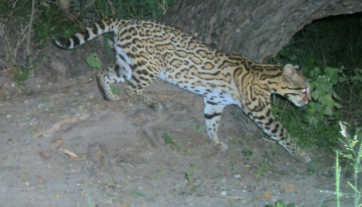
This collision of mountains and desert has created a place of astonishing ecological richness, with habitats ranging from saguaro-studded plains to spruce-fir forests above 10,000 feet. The Sky Islands is the most biologically diverse part of the U.S.-Mexico border, home to half the bird species in North America during at least part of the year. The Coronado National Forest, which encompasses many of the ranges on the U.S. side, is the most biologically diverse national forest in the country, and also has the highest number of threatened and endangered species, including jaguars (Panthera onca), ocelots (Leopardus pardalis), and Mexican spotted owls (Strix occidentalis lucida).
“People have this idea of the border as a wasteland, a war zone,” says Valer Clark, who manages extensive properties on both sides of the border for the Cuenca de Los Ojos Foundation, a conservation group. “That isn’t the case at all. This is a very rich landscape. It’s a crucial place to preserve.”
But the threat of urban development only increases as the region’s human population grows. In addition, dams, mines, ranches and farms have fragmented and degraded natural habitats throughout the region. As a result, most of its once-extensive wetlands, critical to migratory birds and other native species, are already gone. On top of that, the specter of climate change looms large over the arid region, disrupting rainfall patterns and contributing to more frequent and more intense wildfires. Add in illegal immigration and the booming cross-border drug trade, and you have a place that is as complex politically as it is ecologically.
Through the middle of it all, like the thread of a complicated plot, runs the international boundary. About a third of that line is already blocked by some kind of barrier, from barbed-wire fences and tall metal walls to “Normandy fencing” made from steel Xs that look like they’ve been pulled straight off a World War II beach. Most of the barriers are near cities and in places where illegal crossings are most likely to occur. That leaves the more remote, rugged stretches of the border still unfenced—for now.
The environmental impacts of the existing border barriers are mostly unknown, in large part because of how recently and quickly they were built. The Department of Homeland Security waived environmental laws when it put up most of the wall or fencing during a period of “border hardening” in the 2000s. Scientists didn’t have a chance to conduct baseline studies that would allow them to compare the movements of animals, and the overall health of ecosystems, before and after the barriers went up. Construction also included the building of hundreds of miles of access roads, which are known to affect wildlife mobility and cut through populations, especially those of large carnivores and herbivores. A 2014 study on the effects of border infrastructure in four protected areas in Arizona found that barriers curtailed the movement of mammals such as mountain lions (Puma concolor) and coatimundis (Nasua narica)—but had no measurable effect on people trying to cross the border illegally.
The barbed wire fence at the Rancho los Fresnos clearly was not a barrier to beavers. They likely followed the water that flows south from the Huachuca Mountains across the border, which, in a quirk of hydrological irony, merges with the flow from the ranch’s springs and joins the San Pedro River to flow back north into Arizona: two watery border crossings within a handful of miles.
The largest free-flowing river in the southwestern U.S., the San Pedro once teemed with so many beavers it was nicknamed the “Beaver River.” But by 1900, the species had been wiped out by hunters and trappers in search of pelts, and by ranchers and farmers who were frustrated by the animals’ penchant for diverting precious water.
In 1999, the Bureau of Land Management (BLM) began reintroducing beavers in southern Arizona. Improving the landscape was part of the goal: Beaver dams help retain water through the dry season, encouraging the development of riparian areas and the water-dependent plants and wildlife they support. The project was a success, with hundreds of beaver ponds springing up north to the Gila River, and south across the border. The animals first showed up in Los Fresnos after a series of severe storms in 2008, Carreón says. “Everything around here flooded; then we started seeing gnawed tree trunks.” He estimates that three beaver families, each with four to five individuals, live on the property today.
Researchers from the U.S. Geological Survey and the University of Arizona found that the beavers’ environmental engineering has already had a measurable effect along the upper San Pedro. Places where the aquatic rodents colonized, including some sites in Los Fresnos, had a wider variety of birds and more of them, including threatened and endangered species like the Southwestern willow flycatcher (Empidonax traillii extimus). Clearing out large trees and creating ponds and marshes encourages new growth of trees and bushes at the water’s edge, which in turn attract insects and the birds that eat them. This transformation is particularly important along the San Pedro, which is used by more than 300 bird species during their migrations between North and South America. If there had been an impassible wall along the border, of course, the beavers would have stayed in the U.S. and none of this would have been possible.
Another species whose border crossings have been making news lately is the jaguar. The largest cat in the Western Hemisphere once ranged from Patagonia to the Grand Canyon. But by the 1960s, jaguars were largely gone from the U.S., killed by hunters and ranchers protecting livestock. The nearest breeding population was a small one in northern Sonora.
Lone male jaguars were killed by hunters in Arizona in 1971 and 1986. In 1996, a rancher named Warner Glenn was hunting mountain lions in New Mexico’s Peloncillo Mountains when his dogs treed a jaguar instead. He chose to shoot the cat with a camera instead of a rifle—the first time a jaguar had been left alive in the U.S. in decades.
Since then, more have been spotted north of the border, where they have received a decidedly mixed welcome. In 2009 a male jaguar, called “Macho B,” was trapped south of Tucson by a biologist working for the Arizona Game & Fish Department. Estimated to be 16 years old, Macho B was the oldest known wild jaguar, and had been documented on trail cameras crossing the border in both directions for five years.
The animal was sedated, radio-collared and released but eventually had to be recaptured when it became clear something was wrong. Veterinarians found the cat’s kidneys were failing, possibly from the sedative (a drug meant for bears). Eventually Macho B had to be euthanized. The public was outraged and the events became a major scandal, complete with accusations of agency misconduct and criminal prosecutions of whistleblowers.
Two years later another male, dubbed “El Jefe” (The Boss) by local school kids, showed up on trail cameras in the Santa Rita Mountains near Tucson. Wildlife biologist Chris Bugbee studied El Jefe for four years. Bugbee and his wife, Aletris Neils, also a biologist, run Conservation CATalyst, a small nonprofit dedicated to protecting wild cats, out of their home in Tucson.
Bugbee got to know the cat better than anyone. Sometimes El Jefe turned the tables. “I know he followed me,” Bugbee says. “More than once he was the first animal to appear on the camera traps after I left. Once it was only 16 minutes later.” After appearing in hundreds of trail camera images, El Jefe disappeared in late 2015. “He was behaving differently toward the end, staying out in the daylight,” Bugbee says. He thinks the cat probably returned to Mexico to breed.
Biologists like Bugbee and Neils think solo males like El Jefe and Macho B are dispersing north from a population of 125 to 150 animals in northern Sonora, searching for new territories, and possibly mates, at the fringes of their range. (This is one reason the Sky Islands region is so diverse; all these adjoining habitats bring together many species at the edge of their ranges—the biological equivalent of the cantina in Star Wars.) While the increase in sightings is partly because researchers are using more trail cameras, detecting animals they would have missed in the past, Bugbee says, it’s clear that jaguars are starting to push back north across the border. He, Neils, and other experts agree that Trump’s wall would mean the end of jaguars on the U.S. side.
“It’s absolutely essential that the jaguars in northern Mexico be able to expand their range and numbers, to build resilience in the population,” says Randy Serraglio of the Tucson-based Center for Biological Diversity (publisher of The Revelator). “They’re extremely vulnerable because they’re pinned into these small, fragmented areas.” Individuals who push out into new territories can be the most important of all to a species’ survival, he says. “Those are the pioneers who develop new skills, adapt to new habitats.”
Public support is overwhelmingly on the side of bringing the big cats back, Serraglio says. “All of Tucson went nuts when El Jefe became this rock star.” Yet conservationists have found themselves at odds with government agencies and interest groups representing ranchers and farmers, many of whom aren’t thrilled by the idea of bringing back a large predator. After the Macho B debacle, “jaguar recovery is a political nightmare for the U.S. Fish & Wildlife Service,” Serraglio says. The Center has had to sue the agency to get the cats listed under the Endangered Species Act and to declare critical habitat for their survival and recovery as the law requires. The species was listed in 1997.
In March 2014, the Department of the Interior designated 3,092 square kilometers (764,207 acres) of southern Arizona and New Mexico as critical jaguar habitat. In response, the New Mexico Farm and Livestock Bureau and the New Mexico Cattle Growers’ Association filed suit, arguing the decision was “unlawful, arbitrary and capricious.” The key point of contention is whether jaguar habitat north of the border is critical to the species’ recovery. The Fish & Wildlife Service and Arizona Game & Fish Department have both argued that it isn’t, and that jaguar conservation efforts should instead be focused in Mexico.
In December 2016, the Fish & Wildlife Service and a bi-national Jaguar Recovery Team released a 508-page draft recovery plan that lays out a 50-year, $606 million strategy to bring the big cats back in all 19 countries they inhabit. It identifies an area including parts of Arizona, New Mexico and northern Mexico as one of two critical recovery zones—the other stretches from Mexico to Argentina—but doesn’t include reintroducing females into the U.S. Southwest. Neils says the opportunity to breed is critical. “Once we have a female here, I think we’ll have cats permanently.”
The existing border walls probably don’t affect jaguar movement much, Neils says, since they prefer to stick to higher-elevation routes where there currently aren’t any barriers. The irony is that the animals are already beginning to repopulate their historic range in the U.S. on their own, she says, compared to expensive species restoration projects that can drag on for years. “They’re solving the problem for us. We can bring them back for free, just by doing nothing!”
El Jefe himself likely came from a 55,000-acre reserve in northern Sonora owned by the nonprofit Northern Jaguar Project (NJP). In addition to managing the property, the group runs a program called Viviendo con Felinos (Living with Felines), which pays nearby landowners for every animal caught on trail cameras set up on their properties. A jaguar is worth 5,000 pesos, about $275. Other species are worth less, but each can pay off multiple times. In exchange, Viviendo also requires a pledge from participants not to harm wildlife on their properties bordering the reserve.
The program shows how it’s possible to shift landowners’ perspectives on jaguars, says Diana Hadley, NJP president. Ranchers often consider large predators a threat to their herds, but since the program began in 2003, Hadley says, there hasn’t been a single instance of a jaguar killing a cow or calf on any of the properties in Mexico. Meanwhile, the group has assembled what may be the longest continuous database of jaguar sightings, with hundreds of photos of more than 50 different cats. “There’s a waiting list to get into the program,” Hadley says. “The ranchers have been thrilled,” both by the payments and the sense of pride they get from having such a revered creature on their land. At Christmas, each rancher gets a photo book of “his” animals.
On a warm May evening, some of these photos began to appear as huge projected images on the rusty metal posts of the border fence separating Douglas, Arizona from Agua Prieta, Mexico. A 20-foot tall jaguar was replaced by a mountain lion, then an ocelot (Leopardus pardalis) —a smaller spotted cat—and finally a kit fox (Vulpes macrotis) with a bushy tail the size of a Subaru.
A small crowd milled on the American side under the gaze of officers in a Customs and Border Patrol truck idling under a pastel sunset. A similar crowd on the Mexican side was visible through the narrow gaps between the posts. People chatted through the fence as others played music and gave speeches.
Diana Hadley of the NJP, which organized the cross-border event, took the microphone. She explained that the images were all species whose movements are affected in some way by the existing wall. Then she introduced Diego Ezrré, one of 12 Mexican ranchers taking part in the Viviendo program. “The reserve is a great neighbor,” Ezrré said in Spanish. “Because there are more forest animals, we have less depredation by jaguars and pumas.”
“This is the first place we’ve had this exhibit,” Hadley said as stars began appearing overhead. “But I hope we can take it all the way across the border, from California to Texas.”
“To the White House!” called a voice from the crowd.
Some of the jaguars showing up in Arizona almost certainly passed through properties owned by the Cuenca de Los Ojos Foundation (CLO), which manages eleven ranches in the upper watershed of the Yaqui River: two in Arizona’s Chiricahua Mountains and nine in Sonora. The properties range from grasslands to desert to mountain woodlands. Together they harbor more than 25 species listed as threatened or endangered in the U.S.
Driving along Mexico Route 2 in a black pickup with tinted windows, David Hodges, the group’s director of conservation, points out slim white towers jutting from the hills across the border. They’re part of a new remote surveillance network. “Sometimes we see puntos, spotters, on the hills over here,” Hodges says. “They sit in pickup trucks with binoculars and radios, keeping an eye on the Border Patrol for the smugglers.”
The highway has no shoulder and is packed with semis. In the driver’s seat, José Manuel Pérez, CLO’s director of operations for Mexico, sips from a huge sweating soda cup. He turns off the highway at the Rancho San Bernardino, about 15 miles east of Agua Prieta. A desert cottontail bolts up the dirt road ahead of the truck, zigzagging in puffs of dust. The 60-square-kilometer (15,000-acre) ranch was in terrible condition when the foundation bought it in 2000, Hodges says. Previous owners had farmed and ranched it close to death, leaving behind deep arroyos and denuded hills infested with invasive weeds.
The Ciénega San Bernardino used to be the largest wetland in the region, an important stopover for migratory birds that covered thousands of acres. By the 1980s, however, it had shrunk to barely 20 hectares (50 acres).
Hodges rolls up his window as the truck approaches a group of white beehive boxes in the shade of a cottonwood. “They’re a little aggressive this time of year,” he says. The ranch is home to more than 325 species of bees and 240 species of butterflies, the most diverse populations in the world and North America, respectively.
Pérez stops the truck at Silver Creek, a tributary of the San Bernardino River. He walks through a thicket of thorny mesquite bushes to the dry creek bed. A few dozen yards downstream, a 5-foot dropoff cuts sharply across the sand. The ledge is formed by square wire cages, each about the size of a dishwasher and filled with rocks.
Valer Clark, a Manhattan-socialite-turned-conservationist, started buying properties in the Southwest 25 years ago. Through the foundation, she has poured decades of work and millions of dollars into bringing 607 square kilometers (150,000 acres) of damaged lands back to life, replanting native grasses and reintroducing native fish, deer and turkeys. But all this life needs water, so restoring natural flows has been a top priority.
The wire cages, called gabions in Spanish, are a low-tech and relatively inexpensive way to alter the flow of water without blocking it completely, Hodges explains. In the desert, soils laid bare by grazing and agriculture are washed away by summer monsoons. Precious water rushes through deep, narrow gullies without much soaking into the ground. Building ledges and berms out of gabions slows down the flow. Water lingers, meanders, and deposits sediment that fills in and widens the streambeds. With enough work and maintenance, eventually the streams start to look like what they used to be before human activity changed the landscape.
Clark and her employees have built thousands of gabions and small rock dams, called trincheras, on the foundation’s properties. Together with replanted vegetation like willows and cottonwoods, they have brought overgrazed and drought-stricken streams like this one back to life. “This has filled in twelve feet since Val started restoration work,” Hodges says.
Clark lives on El Coronado ranch, one of the properties in the Chiricahuas. After years of flow restoration, “now the mountains are weeping water after the rainy season,” she says. The hills are covered with grass again, and Coues deer, black bears, and Gould’s turkeys roam.
“This is a token effort,” Clark admits. “We’ve made one creek up here run.” But the water table at San Bernardino has risen 30 feet in the past eight years, compared to other places nearby where it has fallen hundreds of feet. The wetlands have expanded, and bird and mammal populations are rising.
A few hundred yards up the streambed, a vehicle barrier marks the international boundary. (San Bernardino has 35 miles of border forming its northern edge.) Illegal border crossings have slowed dramatically here in recent years, Hodges says, because of increased security as well as the improving Mexican economy. “Jobs that used to pay 10 times as much in the U.S. now only pay three times as much,” he says. “The wall never worked anyhow—it was basically a speed bump.”
On the opposite side of the fence is the San Bernardino National Wildlife Refuge, whose main objective is protecting threatened desert fish like the Yaqui chub (Gila purpurea) and the Yaqui beautiful shiner (Cyprinella formosa). Though it’s only a few steps away from where we stand, to get from there to the ranch legally requires driving west on Geromino Trail to Douglas, passing through the checkpoint to Agua Prieta, and then back east on Route 2. On a good day, it takes an hour.
The existing border wall is already a major impediment to international conservation efforts, says refuge manager Bill Radke. Regulations have tightened and cross-border travel is more difficult for government employees. “There was a time when you could just walk across the border and measure stuff, but times have changed,” he says. “Now what would have taken an hour takes a day.” Nonetheless, “if you’re suddenly faced with a landscape that’s being divided, barricaded, fragmented, it does force you to think of options and partners you might not have thought of.”
The refuge has coordinated with CLO to share data on erosion control, ground water levels, and fish and bird populations. When the refuge had to thin out cottonwoods and willows for security reasons, they dug them up and handed them across the fence to workers at San Bernardino, where there were replanted. Some they simply tossed in the river and let them float across.
This fall, CLO will launch the Great Southwest Corridor initiative, to ensure that cross-border wildlife routes in the Sky Islands region remain intact and functioning. While the program predates Trump’s wall plans, according to CLO’s Hodges, it is a response to “longer-term political uncertainty” related to how the border is secured. Potential partners include conservation groups like The Nature Conservancy, the Sierra Club, and Defenders of Wildlife, as well as private U.S. landowners and Native American tribes.
“We’re at a very important point right now,” says Gerardo Carreón of Naturalia, another CLO partner. “People on both sides of the border are coming together and saying, ‘We have to do something.’”
Nonetheless, back in March the Department of Homeland Security started soliciting design prototypes that were both “aesthetically pleasing” and “physically imposing.” (The president himself has suggested the wall could be transparent and/or covered with solar panels. He has also backed away from his initial promise of a nearly 2,000-mile-long wall, suggesting it might be just 700 miles long.)
In Texas, New Mexico, and California, the U.S. Army Corps of Engineers has begun drilling and collecting soil samples in preparation for construction. Engineers hired by the Customs and Border Patrol have begun surveying and clearing land for a new wall and two parallel access roads in the Rio Grande Valley of south Texas. Some of the surveys have crossed private land and important wildlife refuges, prompting protests.
Paying for the wall is still very much under debate. In July, the House Appropriations Committee approved spending bills that include $1.6 billion to construct additional wall and fencing along 74 miles of the border. But Senate Democrats have promised to block the funding, and so far, Mexico’s president Enrique Peña Nieto has flatly refused Trump’s request to pay for any part of it. At a rally in August, Trump threatened to shut down the U.S. government if necessary to secure the funding.
In the meantime, animals keep finding their way across. In March, a female Mexican gray wolf was photographed near Chiricahua National Monument in southeast Arizona. It was the first documented wolf from Mexico since reintroduction efforts began there more than two decades ago, Hodges says, and the wolf, like the jaguars, came from and crossed the border on Cuence de los Ojos lands.
And late last year, two new jaguars also showed up in southern Arizona. One was on the Fort Huachuca military reservation near Sierra Vista. Students on the nearby Pascua Yaqui Reservation named it “Yo’oko Nashuareo,” the Yaqui word for jaguar. The other was spotted in the Dos Cabezas Mountains near Wilcox, almost 100 miles north of the border, the farthest north a jaguar has appeared in decades.
Southern Resident killer whales have a shortage of food and an overdose of deadly pollutants.
The first time I saw wild killer whales, I was sitting on an upturned plastic bucket in a small Boston Whaler, cruising around the Salish Sea in the Pacific Northwest.
It was a cool, drizzly morning last October. At the wheel was cetacean expert Deborah Giles of the Center for Whale Research, located on Washington state’s San Juan Island. As we travelled along the island’s coasts, I could see the killer whales’ tall dorsal fins gracefully bobbing like black triangular sails, and slick flukes slipping beneath the calm waves. And of course I saw the whales’ faces, with their characteristic black-and-white grins and dark eyes, which curiously examined our boat.
In four hours Giles and I spotted 15 killer whales, ten of which belonged to an endangered population of about 80 whales in three pods known as the “Southern Residents” and five that belonged to a group of about 150 non-endangered “transients.” Southern Resident killer whales aren’t a separate subspecies but they are genetically and culturally distinct from other killer whale populations.
Most notably, they eat fish, while transients eat marine mammals like seals, walruses and other whales. In the past both populations were healthy, but in recent decades this food preference has led to the Southern Resident’s near-demise, with a more than 60 percent population drop since the late 1800s. In fact a recent report on the Southern Resident population has shown the killer whales’ birthrates have plunged, with 69 percent of pregnancies failing, most likely due to diminished populations of endangered Chinook salmon but also perhaps toxins in the few salmon that they manage to find and eat.
“There is little doubt that a limited supply of salmon is central to the problem,” said Samuel Wasser of the University of Washington, lead author of the study. “That said…its impacts are compounded by toxins stored in fat, bio-accumulated over the animals’ lifetimes. Food stress burns fat, releasing the toxins into circulation where they can do the most damage. Even here though, food stress is the trigger.”
Canada declared the Southern Residents endangered in 2001, and the United States followed suit in 2005, citing limited food supply, boat traffic and marine pollutants such as flame-retardants, pesticides and industrial solvents as major threats to the population. In his most recently published study, Wasser and his team of researchers at the University of Washington studied these factors and their health consequences for the Southern Residents between 2008 and 2014 by running endocrine tests on killer whale feces they found out on the Salish Sea. The team had unusual assistants help collect those samples: specially trained detection dogs that lay on the bow of research vessels and alert their human handlers of whales and whale feces, which the human handlers scoop up and bring into the ship.
When I visited San Juan Island, I met one of the detection dogs — an amiable black Labrador retriever named Tucker — and his handler, Elizabeth Seely of Conservation Canines at the Center for Conservation Biology at the University of Washington. Seely described the process of using to find a dog to find whale feces as “looking for a needle in a haystack but the haystack is constantly moving.” She said she watches Tucker and uses hand signals to instruct the boat’s driver, often Giles, to steer into the wind when Tucker begins acting excited — a sign he’s picked up a scent. Giles must watch Seely, the wind, the water and the whales in order to get close enough to scoop up the feces, but not close enough to startle the whale it came from.
Besides running fecal samples, the researchers counted, identified and assessed the nutritional status of whales visually. “Peanut head,” the name for the physical condition where a killer whale’s head becomes concave around the blowhole, is a sign of starvation, as is visibility of a whale’s ribcage, slanted eyes (indicative of a narrow face) and stunted growth. Use of drones has allowed scientists to easily detect some of these visible signs of starvation in whales from above.
According to experts, the reason for the starvation in the Southern Residents is most definitely a lack of salmon, which make up the largest and most nutritious part of their diet. Wasser and his fellow researchers found that levels of thyroid hormones were lowest in the Southern Resident whales following known drops in Chinook salmon from the Fraser River, while increases in salmon in the river were associated with increases in thyroid hormone levels.
In the past 10 years, salmon — particularly those spawning in the Columbia River — have decreased. While that’s certain, Wasser said what’s not well understood is why their numbers are dropping. Overfishing and habitat loss due to development could play a role in the fish’s demise. However, it appears more likely that the construction of hydroelectric dams on rivers where salmon spawn and migrate are to blame.
“Some say dams are key, including the Snake River dam, which impacts levels of early spring Chinook, some of the fattiest fish known and essential to replenish whales from the harsh winter and sustain them until the Fraser River Chinook run peaks in the summer,” said Wasser.
Giles takes a stronger personal stance when it comes to discussing the threats to survival the Southern Residents face. She said it’s clear that fishing restrictions and dam removal are necessary in order to replenish salmon and killer whale populations in the Pacific Northwest. But making her voice heard has been something she’s been criticized for doing as a scientist.
“I won’t stop telling the truth about what’s happening just because it’s politically ‘incorrect’ or unpopular,” said Giles. “We need to take action now or we’ll lose these genetically and culturally distinct whales forever.”