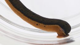
The New England medicinal leech could be a poster child for invertebrate and parasite conservation, according to researchers. We just need to find it first.
Could a five-inch-long, bloodsucking leech inspire efforts to protect other leech species?
Yes, according to researchers — but only if it’s not already extinct.
That’s a possibility, as the New England medicinal leech (Macrobdella sestertia) — a name that dates to the practice of using leeches to “treat” fevers and other health conditions — hasn’t been observed in the wild since 2008.
But it’s gone long unseen several times before. The species, a relative of the much more common American medicinal leech (M. decora), was first described back in 1886, after which no reports of its existence emerged again until 1977. It had been presumed extinct before that rediscovery.
Since then it’s remained a bit of an enigma. Just a handful of reports of its existence have emerged from the leech’s wetland habitats in Massachusetts, Maine and New Hampshire.
We don’t know exactly why it’s been so hard to find — it may always have been rare — but the Massachusetts Division of Fisheries and Wildlife describes it as “likely sensitive to shoreline changes and declines in water quality” and identifies sewage seeps and habitat loss as potential threats.
And maybe we weren’t looking in the right places. Recent research revealed that several New England medicinal leeches were observed in 2002 and 2008 in South Carolina — far outside their previously recognized range. The discovery wasn’t published until 2018.
Another recent finding provides even more hope. Last year scientists at the Smithsonian’s National Museum of National History announced that they’d identified a new Macrobdella species, the first such discovery in 40 years.
For #NationalRelaxationDay we share this hypnotic video…of a LEECH. Its name is Macrobdella mimicus. And it was just described today in the Journal of Parasitology, by our curator of parasitic worms, Anna Phillips @Annalida500, and a team of scientists. pic.twitter.com/3iCQO9h2Uk
They found it just 50 miles from the museum, as well as in museum collections around the country, where it had been misidentified as other species.
“A discovery like this makes clear just how much diversity is out there remaining to be discovered and documented, even right under scientists’ noses,” said lead researcher Anna Phillips, the museum’s curator of parasitic worms, at the time.
That theme echoes in the new paper about the New England medicinal leech by Phillips and Georgetown University biologist Colin Carson. They’re calling for additional surveys to find any remaining populations of the lost species, as well as assessing it to be listed under the Endangered Species Act and the IUCN Red List. They also recommend protecting critical freshwater habitats and creating Red List entries for it and at least a dozen other rare or vulnerable leeches.
If protected or rediscovered, Phillips and Carson suggest that the New England medicinal leech could serve as “the first flagship species for parasite conservation.” As they write in their paper:
“…parasitic leeches are a comparatively easy ‘sell’ for parasite conservation: they are diverse, useful in medicine and as a model organism in developmental biology, striking and often colorful in appearance, have an infamous reputation, and are unlikely to pose a major threat to endangered hosts.”
Of course, the question remains: Does the New England medicinal leech still exist or is it extinct? Phillips and Carson devote the core of their paper to that problem. They used a series of six “extinction date estimator” mathematical models to calculate the probability of the species continued existence based on how often and when it was last observed. Their conclusion: There’s just not enough evidence to support the hypothesis that it’s no longer with us.
That’s potentially good news for now, but it doesn’t mean this species is exactly safe. Two of the six models suggest it might already be extinct, while a third calculates the year it could go extinct as…2020. The other three models give it a little bit more time — anywhere from 2027 to 2046.
As Phillips and Carson note in their paper, only a handful of leech species have ever received conservation protections. Could the New England medicinal leech help turn that trend around? It’s certainly time to try — while there’s still time to try.
Energy policy expert Leah Stokes explains who’s pushing climate delay and denial — it’s not just fossil fuel companies — and what we need to do now.
The first official tallies are in: Coronavirus-related shutdowns helped slash daily global emissions of carbon dioxide by 14% in April. But the drop won’t last, and experts estimate that annual emissions of the greenhouse gas are likely to fall only about 7% this year.
After that, unless we make substantial changes to global economies, it will be back to business as usual — and a path that leads directly to runaway climate change. If we want to reverse course, say the world’s leading scientists, we have about a decade to right the ship.
That’s because we’ve squandered a lot of time. “The 1990s and the beginning of the 2000s were lost decades for preventing global climate disaster,” political scientist Leah Stokes writes in her new book Short Circuiting Policy, which looks at the history of clean energy policy in the United States.
But we don’t all bear equal responsibility for the tragic delay.
“Some actors in society have more power than others to shape how our economy is fueled,” writes Stokes, an assistant professor at the University of California, Santa Barbara. “We are not all equally to blame.”
Short CircuitingPolicy focuses on the role of one particularly bad actor: electric utilities. Their history of obstructing a clean-energy transition in the United States has been largely overlooked, with most of the finger-pointing aimed at fossil fuel companies (and for good reason).
We spoke with Stokes about this history of delay and denial from the utility industry, how to accelerate the speed and scale of clean-energy growth, and whether we can get past the polarizing rhetoric and politics around clean energy.
What lessons can we learn from your research to guide us right now, in what seems like a really critical time in the fight to halt climate change?
What a lot of people don’t understand is that to limit warming to 1.5 degrees Celsius, we actually have to reduce emissions by around 7-8% every single year from now until 2030, which is what the emissions drop is likely to be this year because of the COVID-19 crisis.
Leah Stokes. Photo: Courtesy
So think about what it took to reduce emissions by that much and think about how we have to do that every single year.
It doesn’t mean that it’s going to be some big sacrifice, but it does mean that we need government policy, particularly at the federal level, because state policy can only go so far. We’ve been living off state policy for more than three decades now and we need our federal government to act.
Where are we now, in terms of our progress on renewable energy and how far we need to go?
A lot of people think renewable energy is growing “so fast” and it’s “so amazing.” But first of all, during the coronavirus pandemic, the renewable energy industry is actually doing very poorly. It’s losing a lot of jobs. And secondly, we were not moving fast enough even before the coronavirus crisis, because renewable energy in the best year grew by only 1.3%.
Right now we’re at around 36-37% clean energy. That includes nuclear, hydropower and new renewables like wind, solar and geothermal. But hydropower and nuclear aren’t growing. Nuclear supplies about 20% of the grid and hydro about 5% depending on the year. And then the rest is renewable. So we’re at about 10% renewables, and in the best year, we’re only adding 1% to that.
Generally, we need to be moving about eight times faster than we’ve been moving in our best years. (To visualize this idea, I came up with the narwhal curve.)
How do we overcome these fundamental issues of speed and scale?
We need actual government policy that supports it. We have never had a clean electricity standard or renewable portfolio standard at the federal level. That’s the main law that I write all about at the state level. Where those policies are in place, a lot of progress has been made — places like California and even, to a limited extent, Texas.
We need our federal government to be focusing on this crisis. Even the really small, piecemeal clean-energy policies we have at the federal level are going away. In December Congress didn’t extend the investment tax credit and the production tax credit, just like they didn’t extend or improve the electric vehicle tax credit.
And now during the COVID-19 crisis, a lot of the money going toward the energy sector in the CARES Act is going toward propping up dying fossil fuel companies and not toward supporting the renewable energy industry.
So we are moving in the wrong direction.
Clean energy hasn’t always been such a partisan issue. Why did it become so polarizing?
What I argue in my book, with evidence, is that electric utilities and fossil fuel companies have been intentionally driving polarization. And they’ve done this in part by running challengers in primary elections against Republicans who don’t agree with them.
Basically, fossil fuel companies and electric utilities are telling Republicans that you can’t hold office and support climate action. That has really shifted the incentives within the party in a very short time period.
It’s not like the Democrats have moved so far left on climate. The Democrats have stayed in pretty much the same place and the Republicans have moved to the right. And I argue that that’s because of electric utilities and fossil fuel companies trying to delay action.
And their reason for doing that is simply about their bottom line and keeping their share of the market?
Exactly. You have to remember that delay and denial on climate change is a profitable enterprise for fossil fuel companies and electric utilities. The longer we wait to act on the crisis, the more money they can make because they can extract more fossil fuels from their reserves and they can pay more of their debt at their coal plants and natural gas plants. So delay and denial is a money-making business for fossil fuel companies and electric utilities.
There’s been a lot of research, reporting and even legal action in recent years about the role of fossil fuel companies in discrediting climate science. From reading your book, it seems that electric utilities are just as guilty. Is that right?
Yes, far less attention has been paid to electric utilities, which play a really critical role. They preside over legacy investments into coal and natural gas, and some of them continue to propose building new natural gas.
They were just as involved in promoting climate denial in the 1980s and 90s as fossil fuel companies, as I document in my book. And some of them, like Southern Company, have continued to promote climate denial to basically the present day.
But that’s not the only dark part of their history.
Electric utilities promoted energy systems that are pretty wasteful. They built these centralized fossil fuel power plants rather than having co-generation plants that were onsite at industrial locations where manufacturing is happening, and where you need both steam heat — which is a waste product from electricity — and the electricity itself. That actually created a lot of waste in the system and we burned a lot more fossil fuels than if we had a decentralized system.
The other thing they’ve done in the more modern period is really resisted the energy transition. They’ve resisted renewable portfolio standards and net metering laws that allow for more clean energy to come onto the grid. They’ve tried to roll them back. They’ve been successful in some cases, and they’ve blocked new laws from passing when targets were met.
You wrote that, “Partisan polarization on climate is not inevitable — support could shift back to the bipartisanship we saw before 2008.” What would it take to actually make that happen?
Well, on the one hand, you need to get the Democratic Party to care more about climate change and to really understand the stakes. And if you want to do that, I think the work of the Justice Democrats is important. They have primary-challenged incumbent Democrats who don’t care enough about climate change. That is how Alexandria Ocasio-Cortez was elected. She was a primary challenger and she has really championed climate action in the Green New Deal.
The other thing is that the public supports climate action. Democrats do in huge numbers. Independents do. And to some extent Republicans do, particularly young Republicans.
So communicating the extent of public concern on these issues is really important because, as I’ve shown in other research, politicians don’t know how much public concern there is on climate change. They dramatically underestimate support for climate action.
I think the media has a really important role to play because it’s very rare that a climate event, like a disaster that is caused by climate change, is actually linked to climate change in media reporting.
But people might live through a wildfire or a hurricane or a heat wave, but nobody’s going to tell them through the media that this is climate change. So we really need our reporters to be doing a better job linking people’s lived experiences to climate change.
With economic stimulus efforts ramping up because of the COVD-19 pandemic, are we in danger of missing a chance to help boost a clean energy economy?
I think so many people understand that stimulus spending is an opportunity to rebuild our economy in a way that creates good-paying jobs in the clean-energy sector that protects Americans’ health.
We know that breathing dirty air makes people more likely to die from COVID-19. So this is a big opportunity to create an economy that’s more just for all Americans.
But unfortunately, we really are not pivoting toward creating a clean economy, which is what we need to be doing. This is an opportunity to really focus on the climate crisis because we have delayed for more than 30 years. There is not another decade to waste.
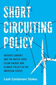
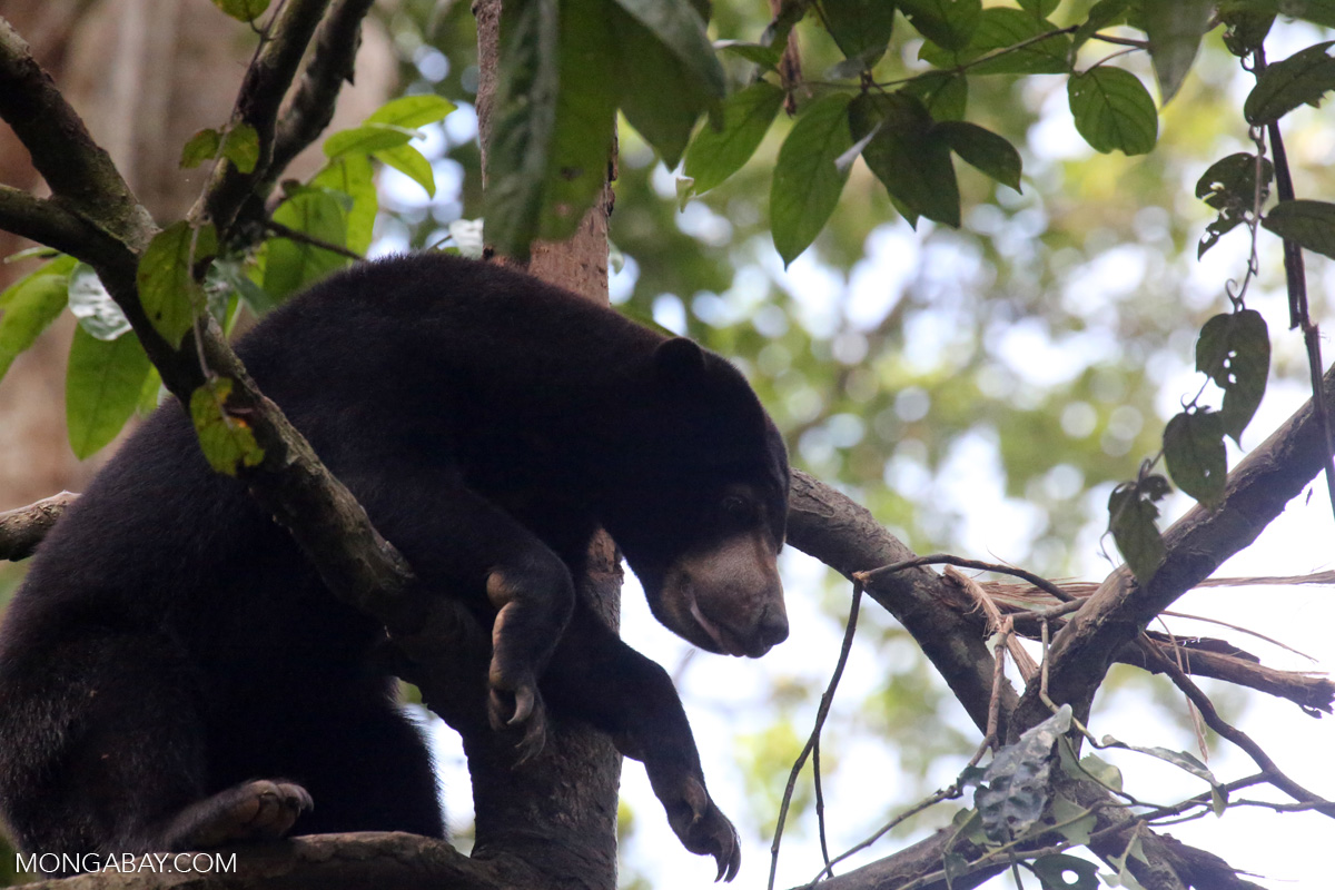
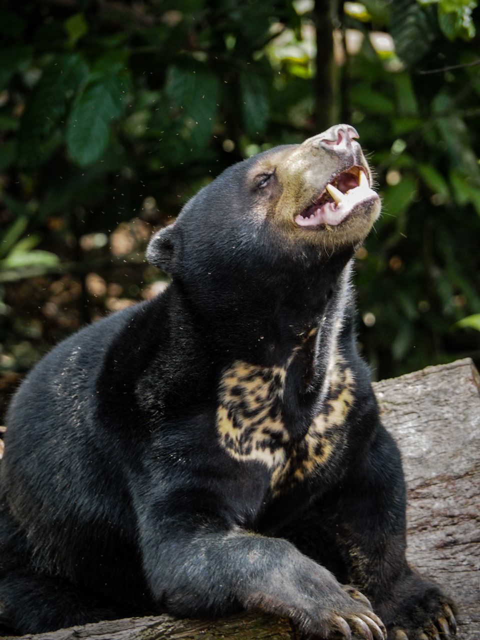
The world’s smallest bears face oversized pressure from poaching, traditional medicine and the illegal pet trade. The COVID-19 pandemic could make things even worse.
Last month, as the world dealt with the crisis of the coronavirus pandemic, China’s National Health Commission proposed an unexpected and potentially devastating treatment for the virus: the injection of “traditional medicine” containing bear bile.
China’s inhumane treatment of captive sun bears — which are kept in tiny, cramped cages and continuously “milked” for their gall-bladder bile for use in traditional Asian medicine — has long earned condemnation from conservationists and animal-rights activists.
But the proposal of using bear bile as a treatment for COVID-19, which is unlikely to have any real medicinal value for coronavirus patients, has implications beyond those affecting the captive-bear population. By creating additional demand for bile and other bear products, it could make things worse for wild bears in Indonesia, a hotspot of poaching and wildlife trafficking.
Indonesia’s Amazing, Threatened Bears
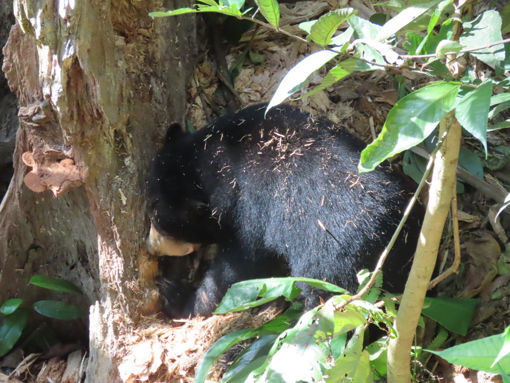
The sun bear (Helarctos malayanus) is a wide-ranging Asiatic species and the world’s smallest bear. Two unique sun bear subspecies live in Indonesia: H.m. malayanus, on the island of Sumatra, and H.m. euryspilus, endemic to the island of Borneo. The entire species faces declining populations and localized extirpations and is considered “vulnerable to extinction” by the IUCN Red List, although these two Indonesia subspecies may be at much higher risk.
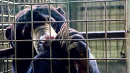
Sun bears are amazing forest dwellers that, as omnivores, have immense ecological value. They drive forest nutrient cycling, seed dispersal and forest regrowth. They’re a form of pest control, since they feed on termites and other insects, and serve as engineers of the forests. Their hunt for ants and bees creates tree cavities that provide homes for various other forest inhabitants, including endangered hornbills.
But their ecological significance is trumped by the contraband worth of their parts, which are highly valued by humans as trophies and charms and for use in traditional medicine.
Historically indigenous communities in Indonesia have always hunted bears for ceremonial clothing, food, jewellery, medicine, protective charms and hunting trophies. This had little impact on wild populations due to the traditional hunting methods used. But hunting methods have evolved and now include the use of firearms, snares and electrocution, all of which make it much easier to kill large animals. Meanwhile ongoing clearing and logging of forests have made wildlife ever-more accessible to poachers, with significant impacts on populations of sun bears and other species.
While detailed population estimates for sun bears don’t exist, Indonesia has been described as an important stronghold for the species, which are found in higher densities here than in any other range state. But the bears face a multitude of threats in Indonesia, not the least of which is illegal wildlife trade.
An Ongoing Threat Moves Online
Our studies, including an analysis of Indonesian seizure data related to bears from 2011 to 2018 and a three-month survey of the online availability of bear-related products on Facebook, reveal an ongoing threat from the illegal wildlife trade in Indonesia. Along with a local demand for sun bear parts such as claws, teeth, skins, skulls or stuffed whole specimens, there’s also the sale of claws and teeth on social media, both in their natural forms and carved into intricate designs or crafted into pendants.
A sun bear in a tree in Malaysian Borneo, its strong claws visible. Photo: Rhett A. Butler/Mongabay (CC)
We also found evidence of the trade in live cubs as pets. For example, a live bear cub was recently seized, along with live orangutans and clouded leopards, in the Indonesian state capital of Jakarta. The animals were en route to Kuwait and were rescued during an investigation into international wildlife trafficking, including shipments to Middle Eastern countries. The Middle East is under increasing scrutiny for its flourishing exotic-pet industry.
And of course, even before the pandemic, there was evidence of more targeted hunting of bears for their gallbladder and bile, used in traditional medicine, and their paws for exotic meat. In January 2018 Indonesian authorities arrested a wildlife trader and confiscated 64 bear paws and 22 frozen Sunda pangolins (Manis javanica) stored in a refrigerator, along with one live pangolin. The items were reportedly purchased from an indigenous tribe in Jambi, West Sumatra, and destined to be sold to Chinese restaurants in big cities in Java.
Cambodia, Malaysia and Vietnam have also been implicated as destination countries in the shipment of bear parts from Indonesia’s East Kalimantan. The largest sun bear seizure in our study period took place in 2017, involving two bear skulls, 266 bones, 24 gall bladders, 1087 claws and 67 canines — all destined for Vietnam. According to the arrested suspect, this was not the first time such a shipment had been sent there.
Lack of Law Enforcement
Wildlife traders in Indonesia clearly have little fear of law-enforcement action. Sun bears have been protected in the country since 1973, yet the illegal trade in live bears, their parts and derivatives all persist.
International regulations are also ignored. Sun bears are listed in Appendix I of the Convention of International Trade in Endangered Species of Wild Fauna and Flora (CITES), which prohibits international trade, but evidence continues to point to Indonesia as a source of trafficked bears to other parts of the world.
As with almost all wildlife crime, this trade — when it’s encountered by law-enforcement officials — rarely results in heavy punishments for the perpetrators. Our analysis of bear seizure data showed that only 32% of incidents resulted in successful prosecution and just one of those cases came close to the maximum penalty afforded by the law. In that case — the January 2018 seizure involving 64 bear paws —the trader received a jail sentence of 4 years and 6 months as well as a IDR100mil fine (approximately $6,900).
Arrests and prosecutions are so low, in part, because traders exploit legislative loopholes in Indonesia’s wildlife laws. While the sale of sun bears, their parts and derivatives remains illegal, the authorities can only take enforcement action against anyone they know to be in possession of protected species, or when suspects are physically involved in an illegal transaction.
Traders are aware of these flaws and manipulate them to their advantage by moving many of their transactions online to Facebook and other social media platforms, which are more difficult for law enforcement to monitor and regulate. Traders can easily set up multiple anonymous social-media accounts and secret trade groups. Face-to-face meetings between seller and buyer are no longer required, as payment can be transferred online and goods can be shipped directly to the buyer. The convenience of these transactions makes it more difficult to for authorities to connect buyers and sellers, which could later be used as evidence in court.
This is not exclusive to sun bears, and all of it ties into the broader network of wildlife trade and smuggling syndicates. In at least 48% of seizure cases involving sun bears, other high-profile animals were seized at the same time, including tigers, orangutans, pangolins, clouded leopards, hornbills and other birds.
Through all of this, we see alarming evidence that bears appear to be of low conservation or legal concern in Indonesia. Instead of facing severe consequences, Indonesians found in possession of a live sun bear — to sell or keep as pets — are merely given an opportunity to surrender the animal.
Necessary Actions to Protect Sun Bears
The threat of illegal trade — combined with loss and degradation of suitable habitat and food resources, as well as conflict with humans — puts sun bears at considerable risk. Now, with COVID-19 potentially complicating things even further by increasing the incentive to poach wild bears, it’s time to implement targeted conservation efforts for the species to ensure viable populations remain in the wild. The IUCN Sun Bear Conservation Action Plan, 2019-2028 already includes useful and practical initiatives to support government agencies in range states. Its recommendations should be immediately put into action throughout the sun bear’s range.
Beyond that action plan, it’s also essential that Indonesia prioritize enforcing its existing legislation to protect bears from poaching and illegal trade. And it’s crucial that the country close its legislative loopholes, which would support and empower enforcement authorities in the investigation and prosecution of illegal wildlife traders operating online. Greater effort also needs to be made to raise awareness of the nation’s wildlife laws protecting species — as well as of the conservation needs of the sun bear. Such outreach should target the public, enforcement agencies, the judiciary, traditional medicine practitioners, hunters and poachers, consumers and villagers living in or near sun bear habitat.
If Indonesia is to remain one of the strongholds for sun bears in the age of COVID-19 and beyond, these protection measures urgently need to be established — before more populations of these incredible, important animals disappear.
The opinions expressed above are those of the author and do not necessarily reflect those of The Revelator, the Center for Biological Diversity or their employees.
We’re already seeing signs of accelerated forest mortality around the world. And it’s not just arid regions that may see forest die-offs, new research finds.
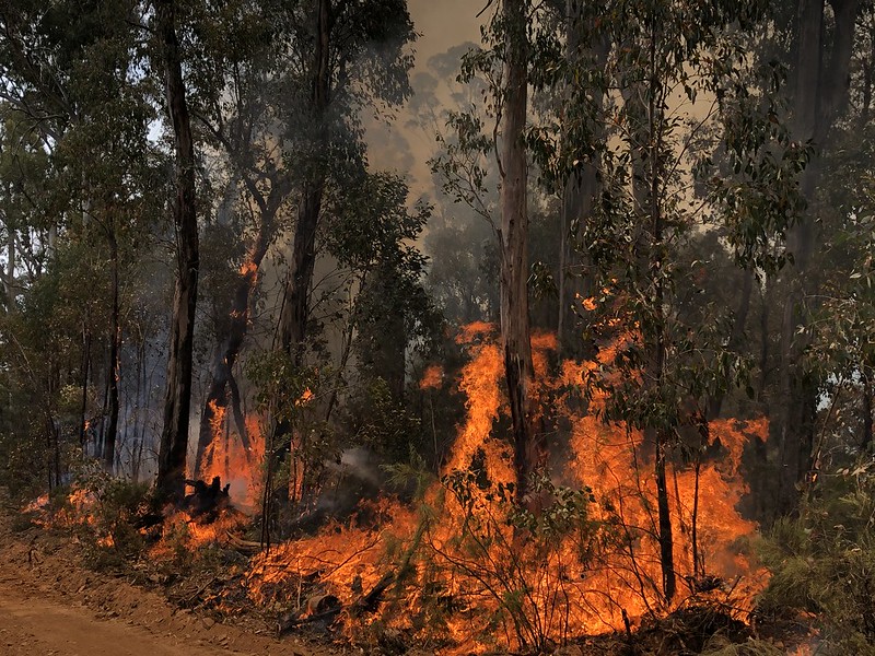
Much of the world watched in horror as Australian wildfires that burned late last year and into the beginning of 2020 incinerated an area the size of Wisconsin, killing 33 people and, by some estimates, more than a billion birds, mammals and reptiles.
But the area of forest that burned pales in comparison to the total area affected by drought worldwide, says Tim Brodribb, a professor of plant physiology at the University of Tasmania. That could lead to a larger, though less headline-grabbing, crisis — and one that’s not confined to just Australia.
Brodribb is the lead author of a new study in the journal Science that analyzed 10 years of research on how forests react to droughts, which are becoming more common and severe due to climate change, even though the damage may be less evident to the eye than the Australian bushfires.
Australian bushfires in 2020. Photo: BLM Idaho, (CC BY 2.0)
“There’s no smoke,” he says, “but there’s a big problem.” In fact, another paper in the same issue of Science found that climate change is driving a decades-long “megadrought” in the U.S. Southwest.
Across the world, forests cover almost a third of all land — and in some places, the ratio is even higher. But if climate change continues unabated, many forests will suffer.
Researchers have used models to understand potential changes to the forest canopy, and “you can easily see 40 to 50% of forests being destroyed in 40 years,” says Brodribb.
The effects could be far-reaching.
Tree species “from rainforests to arid woodlands face similar exposure to stress or damage during periods of drought,” the researchers wrote in their paper.
That would be an astounding change for countless species, as well as humans. Trees provide oxygen and medicine, and they help comprise some of the most diverse ecosystems in the world. Their ability to absorb CO2 is also important, many experts feel, in mitigating the effects of climate change.
“There are already clear signs of accelerated forest mortality, globally,” says Brodribb. “It looks pretty bad.”
Changing Forests
Understanding how forests may respond to climate change is critical, but also complicated.
In laboratory scenarios trees grew faster and larger when there was more CO2 in the atmosphere. That’s led some researchers to wonder if climate change could be good for forests. Faster growth might mean that species can more easily adapt and more quickly spread their young into new areas. More robust trees might help forests survive the other challenges that climate change will bring: more drought, fires, pests and pathogens.
Outside the lab, though, it’s more complicated. For trees, carbon emissions have one big upside, but a lot of downsides.
Due to California’s drought conditions, trees are dying at the Castaic Lake State Recreation Area, April 13, 2016. Photo: Florence Low / California Department of Water Resources
Brodribb and study coauthor Jennifer Powers, an ecologist at the University of Minnesota, say it’s clear now that the calamity that climate change will bring to forests will offset any positive impact that more carbon dioxide might have.
For one thing, high levels of CO2 might spur more leaf growth, but “if you make 20% more leaves, each plant will actually need more water in a high CO2 world,” Danielle Way, an associate professor of biology at the University of Western Ontario who was not associated with the study, wrote in an email.
In a world with more droughts, that’s a problem for trees.
Water molecules are sticky. They cling to one another and pull each other up the inside of a tree’s trunk through the xylem. As the water evaporates out of the leaves, it draws on the water behind it. Most of the time this process, known as transpiration, provides leaves with the constant supply of water they need for photosynthesis, but it also puts water and xylem under extreme tension.
When there is not enough water, the tension can collapse the xylem, a process known as hydraulic failure. Higher temperatures make this failure even more likely because trees “kind of sweat,” says Brodribb. When there is little water, cells called stomata usually close up to keep a tree’s water from evaporating, but under higher temperatures trees keep the stomata open. Water escapes and the tree draws even more moisture out of the soil.
This is what the authors of the Science study call a “universal vulnerability.” Some species may be better adapted to drought and less susceptible to hydraulic failure, but with a perfect storm of warming temperatures and drier conditions, every tree in every forest in the world could be vulnerable.
“I think that the emerging consensus now is that elevated carbon dioxide levels aren’t going to rescue trees from the negative effects of drought,” says Powers.
But some researchers think it’s too early to draw this conclusion.
“Fundamentally there is this tug-of-war between the benefits of CO2 and the stresses of temperature and drought, and we don’t really know when and where which of those two forces might dominate,” says William Anderegg, an assistant professor of biology at the University of Utah who was not involved in the study. “It could vary by region and by forest and of course by climate future.”
It’s also not simply a matter of whether trees may benefit or be harmed — there are degrees of change in forests that could result.
Lucas Cernusak, a biologist at James Cook University who was not part of the study, wrote in an email that if new trees grow quickly where the older trees die, “the 40% mortality over 40 years could take place without a net change in stem density or canopy cover.”
That means the forests of the future could look a lot different from the forests we know today. They’d be more likely to be dominated by faster-growing, weedier trees that die and more rapidly replace themselves. Even then, droughts, pests and temperatures may push trees to their limits. And any major change in the type of forest would have big implications for the species adapted to live in those habitats. When the trees change, whole forest communities could too.
Planning for the Future
Trees that can’t adapt to these new conditions will need to find some better approximation of the world they evolved to live in, rather than the one people are creating. For trees, that’s a slow process and many species may not be able to migrate fast enough to keep up with climate change. For those that do, more research could identify which species handle drought best and how susceptible they are to hydraulic failure, a useful tool for conservationists helping to rejuvenate a forest.
“We can say, ‘Hey, if you’re going to invest a lot of money in restoring a forest, don’t choose these species. They seem very vulnerable to drought,’” says Powers. “With this knowledge, we can help practitioners choose species that will cope better with future climate change.”
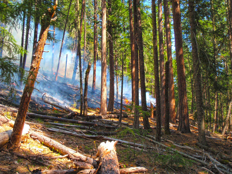
A prescribed burn is used in a western Oregon forest for management. Photo: Bureau of Land Management, (CC BY 2.0)
Still, Powers and Brodribb are skeptical of efforts by organizations like Plant for the Planet to plant more trees in order to soak up carbon and curb emissions. It is much better, says Powers, to help support the forests we do have using tools like assisted natural regeneration, in which people can help speed up the natural way a forest grows.
But in order to conserve the forests of the future — whatever they may look like — more research is needed, and fast. There’s still much we don’t know about how individual species will be affected, and what implications that will have for the myriad organisms that depend on the forests. And of course, much of it hinges on how much carbon dioxide we will emit into the atmosphere.
That uncertainty is what concerns Brodribb. Without accurate information to create robust predictions of what forests look like in a changed world, we risk learning the answers firsthand.
“If we’re not predicting this right, if we don’t get it right,” he says, “then the impacts are so unimaginably bad that … it does keep you up at night.”
The pandemic has changed how conservation research is conducted today, and the effects could be felt long into the future.
Editor’s note: Summer is prime time across much of North America for scientists to do field research outdoors. But this year the COVID-19 pandemic is forcing many researchers to cancel or scale back their plans. Two scholars explain the long-term effects of a missed or downscaled field research season.
By Richard B. Primack, professor of biology, Boston University
Holes in the Data
For the first time in 50 years, ornithologists at the Manomet nature observatory in Plymouth, Massachusetts are not opening their mist nets every weekday at dawn to catch, measure and band migrating songbirds. Due to the coronavirus pandemic, the center has essentially canceled its spring field season and will be doing only very limited sampling. Going forward, its long-term banding data will contain only a fraction of the usual information on songbird migrations during the spring of 2020.
Across the world, field stations, nature centers and universities have shut down long-term research to protect scientists, staff, students and volunteers from COVID-19. There’s good reason for this step, but it comes at a cost.
Collecting data over many years allows scientists to detect gradual trends and short-term anomalies in the health of forests, bays and other ecosystems and biological communities. Long-term research has been crucial in detecting how climate change is affecting the abundance and distribution of species and the timing of spring events, such as bird migrations and plant flowering.
Multi-year data has been vital to understanding how ecosystems bounce back after major disturbances like hurricanes and wildfires. Long-term research has informed policies addressing air and water pollution and wildlife conservation in ways that would have been impossible through short-term studies alone.
Since 1980, the U.S. National Science Foundation has supported a network of Long Term Ecological Research sites that now spans 28 locations, from northern Alaska to Antarctica and across North America. These sites are leaders in detecting effects of air pollution, land use and urbanization on ecosystems. The data they produce is available to the public and the scientific community.
Working Solo
Many long-term studies also take place in national parks, where researchers track subjects like water quality, wetland health and endangered species. In a normal year, armies of researchers and students would be at work in national parks and Long-Term Ecological Research sites. Now, however, just small groups are collecting data, aided by automated equipment.
Richard Primack wears a face mask while repeating Henry David Thoreau’s spring flowering and leafing observations in Concord, Massachusetts. Photo: Richard Primack, (CC BY-ND)
We’re doing this to study the ecological effects of climate change. Our studies have shown that plants are flowering about 10 days earlier in the spring than they did in Thoreau’s time. We have also found that cold-loving northern wildflower species are becoming less abundant, and nonnative species are increasing.
Now I wear a mask, go out early in the mornings when few people are on the trails and work without students. None of this is how we typically work, but it allows me to continue this research and capture anomalies that might occur this year.
But maintaining a few long-term studies won’t make up for irreplaceable losses to science that will occur this year, especially for two-year experimental studies that were supposed to start or end this year. My colleagues and I hope that this pandemic ends soon, so that scientists can get back to analyzing the long-term workings of ecosystems — and the ecological impacts of coronavirus.
By Casey Setash, PhD student in fish, wildlife and conservation biology, Colorado State University
Abundant Uncertainty
Ecologists like me often measure a field season by the numbers: 40 birds captured, 85 nest plots searched, three times when the truck got stuck. This year we’re thinking about Colorado’s coronavirus case count.
My field site sits at an elevation of about 8,500 feet in northern Colorado’s Jackson County. The landscape and lifestyles here have remained largely unchanged over the last century. Jackson is also one of the few counties in Colorado without a positive case of COVID-19.
I’m conducting field work that will inform my dissertation on waterfowl breeding in flood-irrigated agricultural systems, as well as a long-term waterfowl monitoring project run by Colorado Parks and Wildlife.
Answering my proposed questions requires capturing 40 female mallards and gadwall, two common duck species. We mark them with GPS transmitters, conduct biweekly samples in the flooded fields for invertebrates — small crustaceans that ducks eat — and carry out daily nest searches within a 250-square-mile area.
The 2020 field season is the second of three field seasons that I will conduct for my Ph.D., and I had plans to hit the ground running. Instead, we have whittled our six-person crew down to three and are living in trailers without running water, rather than in U.S. Forest Service housing that normally would be available.
Dawn at Casey Setash’s research site in northern Colorado. Photo: Casey Setash, (CC BY-ND)
Our daily routine of cold mornings counting ducks, checking traps and searching for nests feels familiar and comforting. But every task is tinged with worry and guilt. What if we introduce COVID-19 to Jackson County? How are we going to attach GPS transmitters to ducks — a process that usually takes at least two people — while maintaining proper social distancing measures? Scientists are used to estimating uncertainty, but almost everything this year is a question mark.
Long-term projects like these often are replacement data sources when studies like mine go awry. But this year, for the first time since 1955, neither the U.S. Fish and Wildlife Service nor the Canadian Wildlife Service will carry out their Waterfowl Breeding Population and Habitat Survey.
While safety precautions are changing everything, from the amount of data we can collect to the social structure of our field crew, I am one of the lucky few who get to keep working. My field site lies in a sweet spot, between “too far from a hospital” and “too many people.” And it is comforting to be outside with some semblance of normalcy, rather than sitting indoors wondering what the ducks are up to.
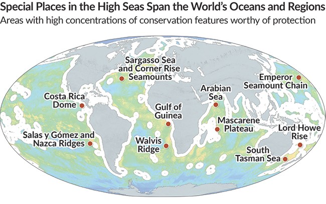
A new study took a deep dive into critical aspects of ocean life to identify the areas of the high seas most worthy of conservation effort.
The Sargasso Sea, an area of the Atlantic Ocean between the Caribbean and Bermuda, has bedeviled sailors for centuries. Its namesake — sargassum, a type of free-floating seaweed — and notoriously calm winds have “trapped” countless mariners, including the crew of Christopher Columbus’s Santa Maria.
For the past 500 years, most of the stories that have come from the Sargasso have been about stranded ships and sunken vessels. But in recent years scientists have rewritten the sea’s narrative. It’s not a life-stealing sea, but a life-giving one. The seaweed alone helps support 100 species of invertebrates, 280 species of fish and 23 species of birds.
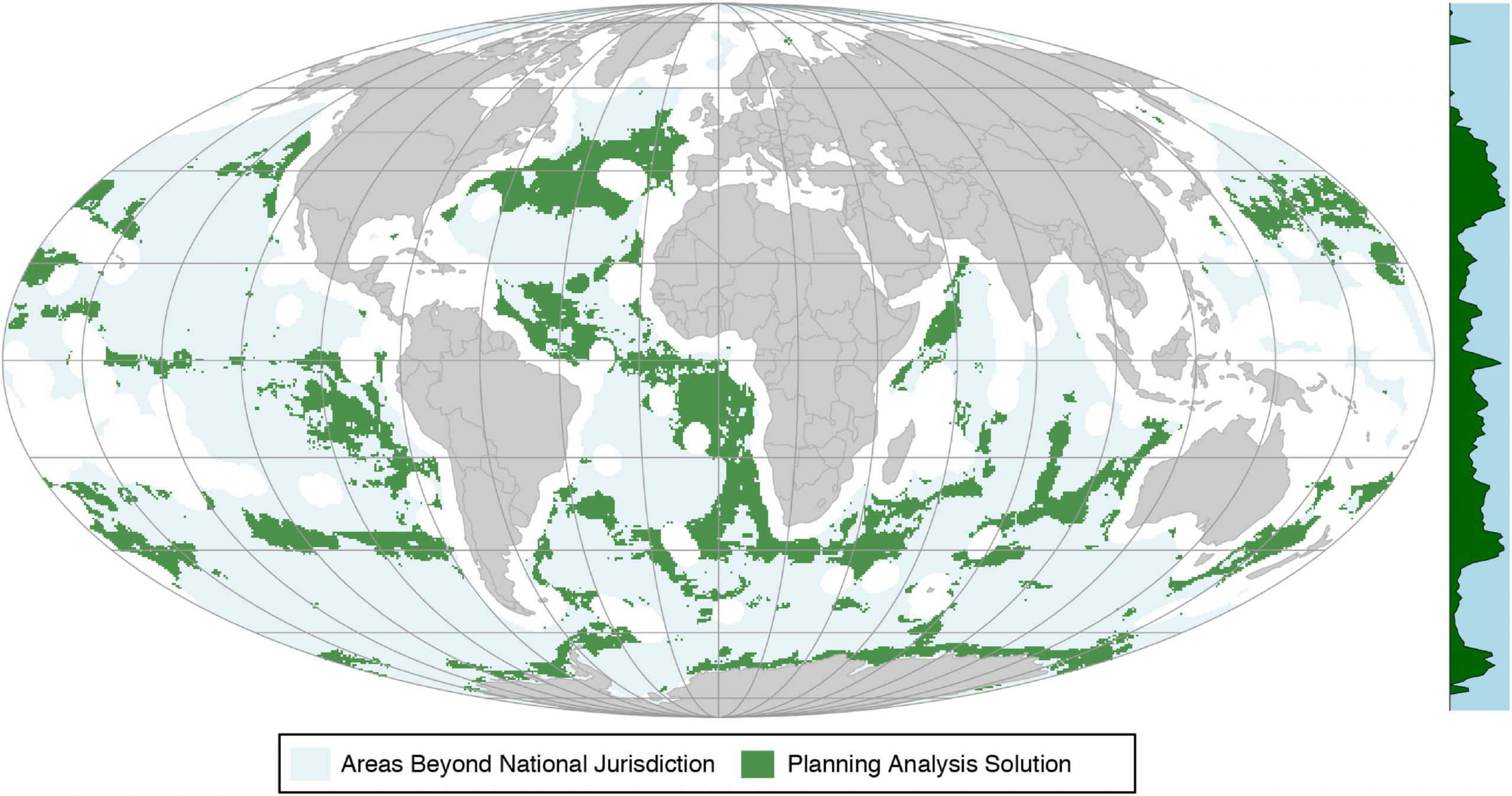
That’s one of the reasons why a team of scientists from 13 universities and institutions included the Sargasso Sea as one of 10 biodiversity hotspots in the high seas — areas of the ocean outside of national boundaries — that their research indicates should be considered for designation as marine protected areas.
Their recommendations, published earlier this year in the journal Marine Policy, took more than a little bit of work to develop.
Results from the global data-driven conservation planning analysis showing priority areas to be considered for protection (green) in marine areas beyond national jurisdiction. Image: Visalli et al
Quantifying the Great Unknown
The high seas make up two-thirds of the ocean, much of which is remote. Scientists are still learning about the diversity and complexity of life there.
“We’re discovering new species in the high seas all the time,” says Morgan Visalli, lead author of Marine Policy study and a project scientist with U.C. Santa Barbara’s Benioff Ocean Initiative.
But at the same time, her colleague and study coauthor Douglas McCauley, director of the Benioff Ocean Initiative, says there’s also a lot we do know that can help guide conservation.
They began their study by reaching out to networks of colleagues across the world to help gather data.
“I was really impressed by how much we actually know — how much data we have for what is out there, biologically speaking,” he says. “And also what people are doing in that space. We can’t fall back on the excuse of not knowing enough.”
The researchers ended up analyzing 22 billion data points — a huge data-processing challenge — to identify areas of the high seas that could warrant protection.
That included looking at indicators such as seafloor habitat, ocean productivity, diversity and richness of species, and extinction risks. They also identified certain physical features — like seamounts and hydrothermal vents — where changes in elevation and temperature help foster biodiversity.
Their results identified priority regions in nearly all the major ocean basins, with the largest areas in the South Pacific Ocean. Key areas also included the Sargasso Sea, as well as the Costa Rica thermal dome in the Pacific Ocean; the South Tasman Sea; the Emperor Seamount Chain northwest of the Hawaiian Islands; the Mascarene Plateau in the Indian Ocean; and the Walvis Ridge, an undersea mountain range off southwestern Africa.
Their model avoided areas of high fishing activity in order to avoid what the study calls “real or perceived negative socioeconomic impacts” of setting aside conservation areas. It also took into consideration how climate change could alter biodiversity by selecting areas critical today and ones likely to be important in the future as well.
The Need for Protection
The research comes at a critical time for the future of the ocean — and the high seas, specifically.
A new United Nations treaty to protect and conserve biodiversity in the high seas is currently being negotiated, and a focus of those talks is how to create a framework for establishing marine protected areas outside of national waters. This could help ensure that unique ecosystems like the Sargasso Sea and others identified in the Marine Policy study aren’t overexploited.
The current law that governs the high seas, the United Nations Convention on the Law of the Sea, was finalized in 1982. But since then, our collective impact is starting to reveal gaps in governance.
Marine shipping traffic is up 1,600% and plastic pollution has increased 100-fold. At least one-third of fish stocks are being overharvested, and many migratory fish species, such as tuna, have declined more than 60%. Technological advances have led to more prospecting in the ocean’s depths for minerals and other genetic resources, as well as more destructive practices, like trawling along the ocean floor. Climate change, which is warming waters and increasing acidification, poses even more risks to ocean life.
Coral bleaching in the Gulf of Thailand. Photo: Petchrung Sukpong, (CC BY-SA 2.0)
This has all taken a toll.
A landmark report last year from the Intergovernmental Science-Policy Platform on Biodiversity and Ecosystem Services found massive declines in biodiversity globally — including in the ocean, with one-third of all reef-forming corals and marine mammals threatened with extinction.
A recent study in the journal Nature, published just a few days after the Marine Policy study, suggests that we’ve come to a critical crossroads.
“We are at a point at which we can choose between a legacy of a resilient and vibrant ocean or an irreversibly disrupted ocean, for the generations to follow,” wrote the researchers, led by Carlos Duarte, a professor of marine science at King Abdullah University of Science and Technology.
They posited that with enough resources and global will, we can see a “substantial recovery of the abundance, structure and function of marine life” by 2050. But to do that, we need to scale up efforts to protect vulnerable species and habitats, reduce pollution and — most critically — curb climate change.
That’s why Visalli and McCauley believe efforts like the emerging high seas treaty are important.
So far fully implemented marine protected areas span just 5% of the ocean. And the vast majority of these reserves are in national waters, which are only one-third of the ocean. But a high seas treaty would help create a framework to more easily set aside conservation-rich areas in a much greater expanse.
“Even though there is industry out there and it has been increasing over the past several decades,” says Visalli, “there is still a lot of wilderness in the high seas, and we are at this moment where we have an opportunity to protect these wild places before industry continues to expand even further.”
To truly protect and restore ocean health, scientists have been calling for a bare minimum of 30% of the ocean to be protected. More protected areas in the high seas are important for meeting that goal. But just as crucial as how much space, is also where that space is.
The Need for Protected Spaces
The major driver for changing and threatening biodiversity in the long term is climate change, says McCauley, which makes protecting these spaces vital in the short term.
“We are already seeing the first manifestation of these threats and we need to think about climate change and always manage the oceans — from fishing regulations to ocean parks — with that in mind,” he says. “Climate change is changing where biodiversity will be in the high seas, and we can use data to plan for that.”
Duarte and authors of the Nature study wrote that “Climate change is the critical backdrop against which all future rebuilding efforts will play out.” But well-managed marine protected areas, they said, can help ecosystems be better equipped to handle threats from climate change, like warming temperatures and changing ocean chemistry.
Getting there won’t be cheap. A global network of marine protected areas that conserves 20–30% of the ocean could cost $5–19 billion a year, the researchers write in Nature.
But supporting local economies, feeding communities, and fostering biodiversity don’t have to be mutually exclusive. The money spent on conservation will be more than returned in economic gains from the new jobs, revenue from ecotourism, restored fisheries, and protections for coastal areas, their research found.
But establishing the policy and international agreements, like the high seas treaty, to set plans in motion will require a lot of compromise, says McCauley.
“We need that space to have an ocean economy and we need that space to have biodiversity,” he says. “Can we find a sweet spot?”
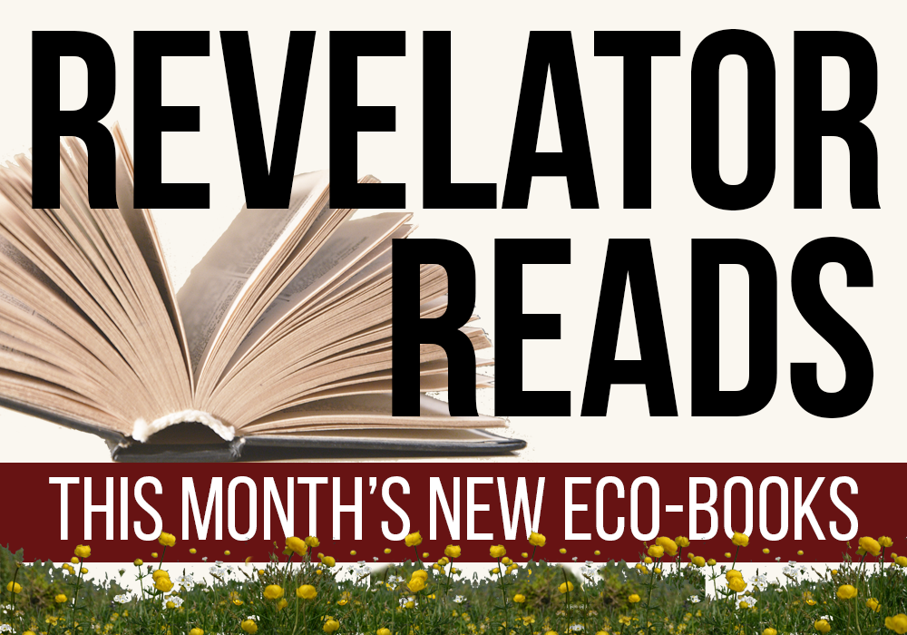
May’s publications cover the amazing lives of elephants, butterflies, eels and fungi, and offer solutions for eco-anxiety and other environmental ills.
When I can’t get outdoors, I like to curl up at home with a good book.
As you might guess, I’m reading a lot of books these days.
And as I read, I’m finding powerful sources of inspiration for the days that will come after our current times of COVID-19 isolation.
Here’s the scoop on 18 fantastic new books — all published this month — offering insight into our natural world, the environmental problems we all face, and strategies for saving the planet and ourselves. You’ll find books about wildlife, climate change, pollution, and environmental justice, with selections for adults and kids. We’ve even got a few novels on the list this month, providing some thought-provoking entertainment.
Obviously most local bookstores are still closed to in-person shopping, but many shops offer curbside pickup or shipping, while publishers and libraries may provide e-books for immediate download. Many of this month’s titles are also available as audio books.
No matter how the books end up coming your way, may they offer the inspiration and tools you need to keep going and protecting the planet.
How do we embrace the urgent need for change without getting bogged down by overwhelming fear and anxiety about the future? The founder of the ClimateMama website offers a concise resource guide that, despite its kids-oriented title, is geared toward motivating entire families — and through them, their larger social circles — into creating positive change for the planet.
The full story of the notorious and horrific Camp Fire that ravaged Paradise, California, in 2018. The authors covered the fires for daily newspapers as flames raged through the town, and now they expand upon their reporting to present the full history and the stories behind the tragedy. Along the way, they provide a potent example and warning of things to come in an increasingly warm, dry, overly developed world.
A book as colorful and varied as its titular subjects, from the bestselling author of The Horse. It’s a thoroughly engaging mix of science, history, culture and personal narrative, as well as a testament to the need to conserve our fluttering friends. It also comes with the best subtitle of the month: “How Thieves, Hoarders, Scientists and Other Obsessives Unlocked the Secrets of the World’s Favorite Insect.”
This stunning graphic novel tells a slightly fictionalized version of one of the first major environmental disasters in the United States, the Lake Erie tunnel fire, and the entrenched racism that nearly made its death toll much, much worse. This book serves as a painful reminder that people died — horribly — so cities like Cleveland could have fresh, disease-free drinking water, and that corrupt politicians and corporations were just fine with the human cost of their actions. (Sound familiar?) MacGregor and Dumm also bring to light the story of Garrett Morgan Sr., the pioneering African-American inventor whose contributions and heroic sacrifices during the tragedy have been mostly erased from the history books — until now.
We’ve already seen several bestselling and powerful books address the Flint water crisis, but this is the first one specifically written for young-adult readers. When you consider that kids were among the worst affected by the Flint tragedy, that makes this a story they need to read and understand — so they can grow up and help prevent it from happening to anyone else.
The operative word in the title is “beyond.” Cox, lead scientist at The Land Institute, walks us through what the current iteration of the Green New Deal misses and what it would take to get to a zero-emissions future. Noam Chomsky provides the foreword.
The author of Coal: A Human History continues her digs into the past, this time to examine how and why corporations so consistently employ delusion and deception to get their way, why so many of us keep falling for it, and how we can shift the narrative.
Fungi are having their moment in the sun, with a magical new documentary and now this entertaining book that dives into the world of mushrooms, molds, yeasts and so much more. Utterly fascinating and eye-opening. The mouther-watering chapter on truffles is worth the price of admission.
As much as we love our pets, our desire for animal companionship comes with a laundry list of environmental ills. Free-roaming housecats and invasive pythons kill native birds (and just about anything else they can find). Dogs carry diseases and harass wild animals. Parrots, songbirds, lizards and other exotic pets are often poached from habitats around the world. Even the toys and food we buy for our pets have an environmental impact. This informative book isn’t about shaming pet owners, though; it serves as a call to action to change the ways we acquire, interact with and support our pets, while also providing us with a sustainable path forward.
An environmentally themed young-adult novel based on Marvel Comics characters, in which T’Challa’s younger sister must save an endangered plant from extinction — and simultaneously preserve a critical element of Wakandan culture.
If you only read one translated-from-the-Swedish treatise on the philosophy, history and science surrounding weird, slippery animals, make it this one. Seriously, it’s bizarre and engaging.
Full disclosure: This powerful, funny and emotional novel about climate change and extinction comes to you from The Revelator’s copyeditor, but really, isn’t that even more of a reason to give it a try?
When pollution harms your physical, financial and spiritual health, it’s more than an injustice. But that’s what happens time and time again in Indian Country. This book addresses situations ranging from Standing Rock to uranium mining on Navajo and Hopi lands through lenses of colonization, sovereignty and — perhaps most importantly — victory.
Most photo books take on an epic scope and try to capture massive concepts or landscapes. This one goes the opposite direction. Helzer spent a year pointing his camera lens at the same tiny plot of prairie land until he captured photos of 113 diverse plant and animal species and the drama that surrounded them. The book also includes a dozen short essays about his experience and the natural history of that one square meter. The whole thing adds up to a magical reading and viewing experience that will inspire you to get down on all fours and stare at the microcosms around us the next time you’re outdoors.
We try not to include too many expensive textbooks on this list each month, but we couldn’t resist this book dedicated to the thorny issues of the laws behind protecting endangered plants. Amos starts by the book by addressing why readers should care about the world’s vegetation and ends it with a chapter critically addressing “humanity’s failure to protect plants.” In between, he discusses threats ranging from climate change to international trade and invasive diseases and devotes two major sections to ways to move forward. This book isn’t for your average home gardener, but it could set the stage for important action toward plant conservation around the world.
If this pandemic has taught us anything, it’s that our current capitalistic systems need an upgrade. This book, by the former chief conservation officer of The Nature Conservancy, aims to help nonprofits and others invest in the land, water and green infrastructure. As such, it unfortunately still embraces the ideal of placing and extracting a financial value from natural systems — heck, the final chapter is even entitled “Finding Wealth in Nature.” That might seem like an immediate contradiction, and yes, there are plenty of questions about how much impact “impact investing” truly has, but at least there’s a values system behind the concept. As such, this might serve, at the minimum, as an important piece of the conversation about our future as we move forward.
This fully revised edition of a classic textbook looks at solving our environmental woes through the lens of social inequality, making it the perfect learning tool for the Greta Thunberg/Alexandria Ocasio-Cortez era of activism and progress.
That’s it for this month. Stay safe and stay tuned for another batch of books on June’s list in a few short weeks. Until then you can find dozens of additional eco-books in the “Revelator Reads” archive.
Transportation, especially commuting, plays an oversized role on global-warming emissions and air pollution. Here’s how much telework matters, and what we can do to improve.
For many Americans across the country, staying home to stop the spread of the novel coronavirus (COVID-19) means adapting to long-term telework for the first time. We’re doing a lot more video conferencing and working out all the kinks that come along with it.
While this particular situation is not ideal for many — for example, I’m currently writing this with an infant in a baby carrier on my chest and our almost-three-year-old belting “Let It Go” in the background — in many ways we’re playing out a real-time experiment on whether telecommuting is possible on a large scale.
Caption: The author (above) wrote this while working from home, baby in tow. Photo: Emily Anderson (author’s wife/home office mate).
The coronavirus will pass, but it’s looking more and more like remote work will stick around. This time has demonstrated that, despite the ups and downs many of us have experienced, telework works for way more of us than we knew.
Even before this we knew that there were several benefits for both employers and employees to sidestepping the office. Studies have shown that it can lead to increased productivity, higher morale and lower employee turnover. It can also reduce real estate and office operation costs for employers.
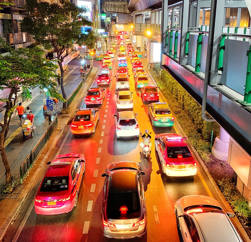
We may now also be seeing some larger societal benefits that make the case for taking telework even further. Our current situation has provided a window into how a reduction in driving, buoyed, in part, by a greater adoption of telework, could relieve some of the stress on our overburdened transportation system and help heal at least a portion of the environmental damage it causes.
Today, roads that would normally clogged at all hours of the day are virtually empty, even during rush hour. And the reduced car travel leads to fewer crashes and less air pollution, which harms human health and contributes to global warming. Air that’s usually cloudy with smog has cleared. Los Angeles, which has notoriously pollution-choked skies, could recently boast having the cleanest air in the world. And this year, experts predict, the transportation transformation will contribute to the largest-ever annual decline in global carbon emissions.
Virtually empty Los Angeles streets on May 7, 2020. Photo: Chris Yarzab (CC BY 2.0)
Clearly not every job can be done from home, and it’s not just commuting for work that has come to a halt during coronavirus lockdowns. In 2017 only around 28% of total miles driven were work-related. Even if telework continues or expands on a much larger scale, non-work-related car trips — shopping, recreation, visits to doctors, and the like — can be expected to go back to normal.
Still, telework’s potential for taking cars off the road can clearly have an impact on global warming emissions and air pollution. Just how much of an impact could telework have? As it turns out, the answer is a significant one — and with a few important steps, the benefits can be even greater and more sustainable.
How Much of the Workforce Could Reasonably and Permanently Transition to Telework?
According to the U.S. Census Bureau, 5.2% of U.S. workers — around 8 million people — worked from home in 2017. But that’s still just a fraction of potential teleworkers. Earlier this month researchers at the University of Chicago found that 37% of U.S. jobs can plausibly be performed at home. The U.S. workforce reached 164.5 million in February 2020, before the pandemic, meaning approximately 61 million of those workers could plausibly telework permanently once the economy starts up again.
Of course, the full economic consequences of this public health crisis are still unknown. It’s possible that coronavirus-related job losses will impact the overall number of those employed for some time. But for these purposes, this assumption of 53 million new remote workers will be useful to illustrate the potential impacts of telework.
How Much Driving Would Full-Capacity Telework Avoid?
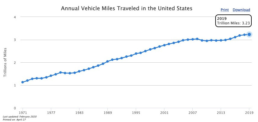
In 2019 Americans drove a total 3.23 trillion miles, according to the U.S. Department of Energy. The DoE doesn’t break that down by reasons driving, but we know that in 2017 there were 683 billion total commute miles driven. Reducing the commuting workforce by about 32% (37% of total workers who could telecommute minus the 5.2% of them who already do) would theoretically decrease commuting totals by about 219 billion miles.
A traffic jam on January 17, 2020. Photo: Raphael Labaca Castro (CC BY-SA 2.0)
Of course telecommuting won’t let us avoid logging all of those miles, since people may occasionally still need to travel to an office for meetings and may need to make new trips they wouldn’t otherwise have taken (you can’t stop at the grocery store on the way home from work when you work at home). Various studies have found that telecommuting actually reduces driving somewhere between 60 and 90% of commute vehicle miles traveled (VMT). We’ll split the difference and calculate that telework reduces commute miles by about 75%, meaning the new teleworkers could avoid around 164 billion miles driven.
Credit: U.S. Department of Energy, Alternative Fuels Data Center
Still, that much of a transformation may not work for everyone, as people will still need to do face-to-face work — and, let’s be honest, the other thing the lockdowns have taught us is to appreciate the value of regular social contact. That said, even if most people worked from home two to three days a week and the actual VMT reduction were closer to 2 or 3%, the difference would still be significant — especially considering that VMT has been steadily rising since the 1970s, except for a few years during economic downturns. Even if just a quarter of American workers started working from home one day a week, total vehicle miles traveled would fall by 1% — not a huge amount, but enough to make a difference on a grander scale.
Impact on Global Warming Emissions
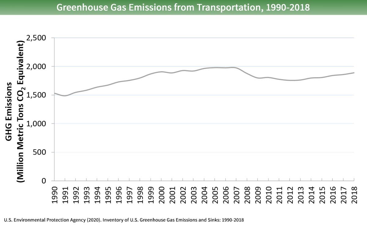
The cars and trucks we drive every day are major sources of air pollution and global warming emissions. Transportation as a whole accounts for 28% of all greenhouse gas emissions in the United States, more than any other source. Light-duty vehicles and medium- and heavy-duty trucks are responsible for 82% of the transportation sector’s emissions.
The average American car or SUV emits 404 grams of carbon dioxide (CO2) per mile traveled. So reducing commuting by 164 billion miles would avoid 66 million metric tons of CO2 emissions annually. These are significant emissions reductions, but they’d only make a small dent in total transportation-related greenhouse gas emissions, which reached nearly 1.9 billion metric tons in 2018.
Nevertheless, it would help us move in the right direction. And while it only represents a small percentage of total emissions, it would still be the equivalent of more eliminating emissions from than 7 million homes’ total energy use for one year, or the same as shutting down more than 16 coal-fired power plants.
Impact on Health-harming Air Pollution
People across America regularly breathe polluted air, which increases their risk of attacks and other adverse health impacts, and even premature death. In fact, in 2018 108 million Americans lived in areas that experienced more than 100 days of degraded air quality. Our cars and trucks are a major source of this pollution, which includes ozone, particulate matter and other smog-forming emissions.
There’s a reason the air has cleared over many of our major cities during the coronavirus lockdowns. When you remove cars from the road, you also remove smog. The lockdowns have resulted in an extreme reduction of VMT — between 68 and 72% across the country (and in some places closer to 90%). Assuming that telework has contributed something close to its peak potential reduction of 7%, it seems likely that it has played at least a supporting role in helping to clear our skies.
Additional Emissions Reductions From Reduced Traffic
The average American commuter wastes 54 hours a year stuck in traffic. That’s lost time with friends and families, lost productivity at work, wasted money, tons of unnecessary stress, and a lot more pollution from idling cars.
Traffic patterns are complicated because traffic is non-linear, meaning there isn’t a one-to-one ratio of percentage of cars removed to percentage of traffic alleviated. As such, just a few extra cars on or off the road can have an outsize impact on traffic. Reducing commute VMT by up to 7% would have a huge impact on rush hour traffic (when bottlenecks are at their worst and most of that driving occurs). A greater adoption of telework could give people back some of those 54 hours so they can spend it doing the things that matter to them. And slow moving or stop and go traffic results in greater emissions than free-flowing traffic. So freeing up the roads and alleviating traffic for the remaining will result in even greater emissions reductions.
What Needs to Happen for Telework to Live Up to Its Potential?
It’s clear that telework can have significant societal benefits, including less global warming pollution and cleaner skies. But significant benefits are only possible if everyone whose job could plausibly be done from home has that opportunity.
To reach that goal, several barriers must be overcome:
Technology: We’ve all had technical mix-ups when using Zoom or Google Hangouts or one of the other conferencing platforms. But the real technological barrier is access to broadband. Roughly three-quarters of American adults have broadband internet service at home, but the rate of access is much lower in rural parts of the country, according to a report by Pew Research Center. Those locations often don’t have broadband infrastructure and even 14% of households in urban areas lack access, usually because they are not able to afford it. States should make funding available to develop broadband capacity in underserved areas.
Employer policies and managerial reluctance: Coronavirus lockdowns across the country have forced employers and managers to adapt to large-scale telework quickly on an emergency basis, meaning these barriers are less likely relevant now than before. But general employer and manager reluctance to embrace working from home has slowed this transition. Cities and states can encourage employer acceptance of telework by providing tax benefits or other incentives for greater adoption.
Car-centered transportation policies: Our current transportation policies often incentivize driving or parking. From commuter and parking benefits to decades of outsized spending on highway infrastructure, we tip the scales toward getting behind an automobile’s wheel. In other words, our transportation policies are meant to move cars rather than incentivize things, such as telework, that would take cars off the road.
We need to rethink this approach and shift toward better “Transportation Demand Management.” This requires the implementation of a set of strategies aimed at maximizing traveler choices. Those strategies should include greater employer and employee incentives for telework, as well as policies designed to facilitate more walking, biking, ridesharing, vanpooling and public transportation use.
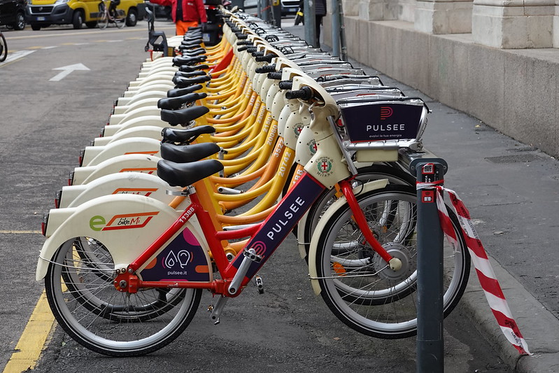
Bikeshare in Milan, Oct. 2019. Photo: Guilhem Vellut (CC BY 2.0)
That’s important, because the potential gains we’d see from telework would only be sustained if that shift were paired with other policies to ensure those commuter miles aren’t just replaced with other trips. We usually talk about this in relation to widening or building new highways, but when you open up highway capacity, it usually fills quickly. This is what the wonks call “induced demand.” People who otherwise would have driven at a different time of day, taken a different route, taken public transportation or would have avoided traffic on the highway some other way, come back to the road. The same could happen here if additional measures aren’t taken.
It’s likely that, even after the coronavirus lockdowns are over, telework is going to become more and more common in the American workforce. As it does, the environmental benefits will be significant. In a time when climate change presents an existential threat to life as we know it and millions of people across the world are subjected to unhealthy levels of air pollution, we need to be taking an all-hands-on-deck approach to solving these problems. Telework can clearly be a significant part of the long-term solution — especially if we take further steps to maximize its potential.
The opinions expressed above are those of the author and do not necessarily reflect those of The Revelator, the Center for Biological Diversity or their employees.
Antibiotic use in agriculture is a ticking time bomb, posing looming health risks to people and the environment.
The emergence of multiple pandemics in the animal agriculture industry over the past few decades, coupled with COVID-19’s suspected origins in wildlife meat markets, has prompted renewed calls from experts to transform the global food system to prevent diseases harmful to humans.
Industrial agriculture puts humans in contact with scores of animals in cramped conditions, which is ideal for disease transfer.
But that’s only one of the health dangers it causes. Antibiotics are used ubiquitously in all kinds of large-scale agriculture, causing antibiotic resistance and environmental toxicity that studies show we’re not prepared to combat.
Watch our new video to learn more about issues arising from antibiotic use in agriculture.
New research reveals clear guidance for reducing human-wildlife conflict and restoring wolf populations.
There’s one clear way to make both wolves and livestock owners happy: Make sure that predators have enough natural prey.
That may seem like an obvious answer, but now we have data to back it up. A team of researchers combed through nearly 120 previously published studies about the diets of gray wolves (Canis lupus) and found that in most cases the predators purposefully select wild prey when it’s available — even when livestock is nearby and abundant.
The paper, published March 20 in the journal Biological Conservation, pulled from research conducted in 27 countries and found consistent results across three continents.
Another conclusion: Owners who leave their livestock out to graze freely, especially in small groups, found their herds more vulnerable to predation. Sites that kept livestock under supervision and penned their animals, especially at night, suffered fewer losses. Using non-lethal deterrent methods such as fences and guard dogs also improved conditions. Not protecting herds, they found, increased the likelihood of predation by up to 78%.
The study also found that wolves show a tendency to eat native species that have their own defense mechanisms — horns, antlers and other sharp bits. Previous research has shown that wolves coevolved with antlered ungulates, making them the ideal, preferred prey.
These results offer clear guidance, according to the authors, who write that “wild prey populations should be maintained and restored wherever possible to provide enough food for grey wolves and to minimize the likelihood that they will attack livestock.” They add that their study may have relevance for reducing conflict between humans and other large carnivores around the world.
Of course, restoring prey populations presents its own set of challenges, but this research illustrates the value of having a healthy ecosystem: It keeps both humans and their domesticated animals safer.

 But it’s gone long unseen several times before. The species, a relative of the much more common American medicinal leech (M. decora), was first described back in 1886, after which no reports of its existence emerged again until 1977. It had been presumed extinct before that rediscovery.

 Here’s the scoop on 18 fantastic new books — all published this month — offering insight into our natural world, the environmental problems we all face, and strategies for saving the planet and ourselves. You’ll find books about wildlife, climate change, pollution, and environmental justice, with selections for adults and kids. We’ve even got a few novels on the list this month, providing some thought-provoking entertainment.
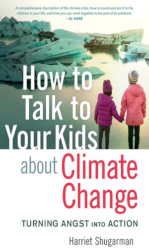 How to Talk to Your Kids About Climate Change: Turning Angst into Action
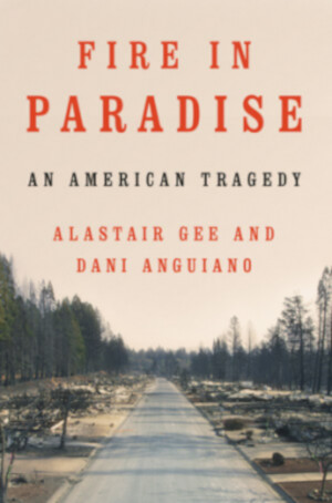 Fire in Paradise: An American Tragedy
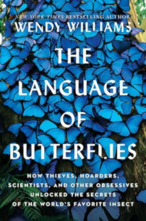 The Language of Butterflies
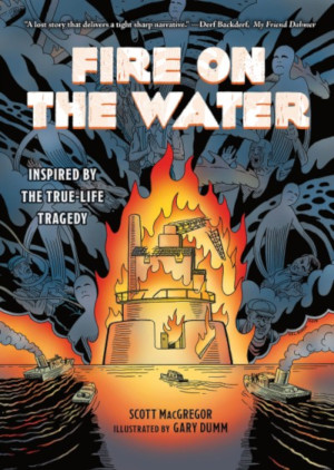 Fire on the Water
 Poisoned Water: How the Citizens of Flint, Michigan, Fought for Their Lives and Warned the Nation
 The Green New Deal and Beyond: Ending the Climate Emergency While We Still Can
 Elephants: Birth, Life, and Death in the World of the Giants
 Industrial-Strength Denial: Eight Stories of Corporations Defending the Indefensible, from the Slave Trade to Climate Change
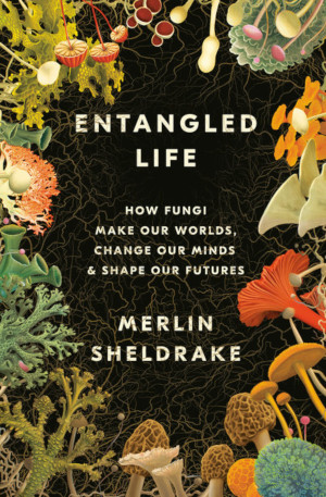 Entangled Life: How Fungi Make Our Worlds, Change Our Minds & Shape Our Futures
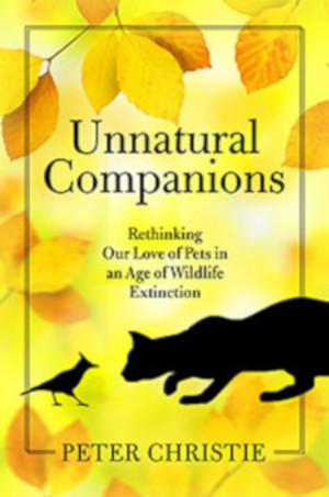 Unnatural Companions: Rethinking Our Love of Pets in an Age of Wildlife Extinction
 Shuri: A Black Panther Novel
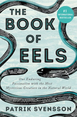 The Book of Eels: Our Enduring Fascination with the Most Mysterious Creature in the Natural World
 A Children’s Bible
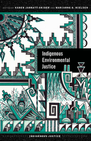 Indigenous Environmental Justice
 Hidden Prairie: Photographing Life in One Square Meter
 International Conservation Law: The Protection of Plants in Theory and Practice
 Valuing Nature: A Handbook for Impact Investing
 Gender and Environment, 2nd Edition


 Nevertheless, it would help us move in the right direction. And while it only represents a small percentage of total emissions, it would still be the