
On March 3 Randy Moore, the 20th chief of the U.S. Forest Service, stepped down after a lifelong career that started in 1981. A soil scientist and forester, Moore was also the first African American chief of the Forest Service. His resignation came on the heels of a widespread wave of mass firings of Forest Service personnel that amounted to approximately 10% of its workforce. In his farewell letter, Moore laid bare his frustration regarding the ongoing dismantling of the agency and the need for personnel to stick together and remain nimble, adding that for those in the Forest Service “feeling uncertainty, frustration, or loss, you are not alone.”
Moore was replaced by Tom Schultz, a timber executive with deep ties to the logging industry. Schultz is also the first chief in Forest Service history who has not previously worked in the agency. In his introduction letter, Schultz highlighted his 25 years of land management, focusing on his timber and mineral extraction directive roles in Idaho.
This change in leadership provides a clear example of what the Trump administration means to do to federal agencies and public lands: crush agency capacity, shift focus from conservation to exploitation, and bring private interests directly into public agencies whose mandate is to serve the public.
By weakening protections — and decimating the agencies in charge of enforcing those that are left — the Trump administration will ensure that economic activities have primacy over everything else, including, perhaps, the rule of law.
This shift is rooted in the ideology that nature should be commodified to the utmost extent allowable, and it’s part of a bigger strategy determined to withdraw the state from public life and toward a capitalist economy unrestrained from “unnecessary burdens” like public and environmental protections. Project 2025, the right-wing playbook for this presidential administration, includes detailed instructions to achieve these goals, primarily through diminishing the ability of the administrative state to fulfill its duties.
While much of this has been highly visible, just as much has not.
When austerity-minded governments cut services, often branded as “downsizing,” the costs end up in one of two places.
They can go to government contracts in the private sector, if agencies are expected to keep providing the same services or doing the same amount of work.
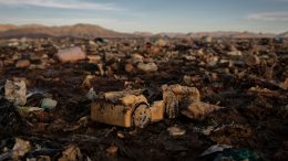
Or, if an agency is left resourceless and reduces its work, these costs become social and environmental externalities that fall first and foremost on frontline communities and affected ecosystems.
We’re already seeing the ground laid for both these outcomes, with dire consequences for our public lands and waters.
For example, the National Oceanic and Atmospheric Administration — a building block of the nation’s system for earth monitoring, climate research, and emergency preparedness and response — is preparing to lay off more than 1,000 employees — just ahead of hurricane season.
Even more concerning is the fate of the Department of the Interior, the agency responsible for managing more than 500 million acres of public lands, 700 million acres of subsurface minerals, and 1.7 billion acres of the Outer Continental Shelf. All these resources are now up for grabs to the highest bidder. During CERAWeek, an energy industry meeting organized by S&P Global, Interior Secretary Doug Burgum said that “If the Interior Department was a stand-alone company, it would have the largest balance sheet in the world, bar none.”
Many of us feel overwhelmed by these changes, which was itself central to the strategy laid out by Project 2025.
We need an approach that allows us to make sense of this new reality. I believe we can understand this “war on nature” by grouping the administration’s actions into three main buckets:
Bucket 1: Fewer Legal Protections
The Trump administration is implementing a coordinated effort to weakening our entire system of public and environmental protections, including federal regulations, operational guidelines and policies, tools such as Resource Management Plans, emergency declarations to bypass environmental reviews, and others. These provide legal and policy guidance for questions of resource extraction, infrastructure buildout, and balancing different policy goals, like development vs. conservation.
In the Department of the Interior, for example, the Trump administration has initiated a push to revise all management plans finalized during the Biden administration. These plans govern the full range of activities that can occur on public lands, including off-highway vehicle use, wildland fire and wildlife management, mineral leasing, and livestock grazing. The revision of these plans was included in one of Trump’s first Executive Orders and a Secretarial Order that soon followed.
There has also been a push for broad deregulation, best captured by another EO called “Unleashing Prosperity Through Deregulation,” which according to Sharon Block, former OIRA official from the Biden administration, has the potential to be destructive to the “system of rights and protections that our regulatory system has provided for the public since the New Deal.”
Other avenues for eliminating protections include changes in policy implementation, suspension of departmental policies that prioritize conservation and restoration or environmental legal opinions, and redefinition of what is protected under current laws.
Additionally, the administration can misuse processes meant to act as environmental safeguards, as they did when they improperly used emergency declarations to fast-track the approval of pipeline construction by the U.S. Army Corps of Engineers. The administration has also indicated a preferential or expedited permitting process for investments over $1 billion. This list is not exhaustive.
Bucket 2: Increased Leasing and Resource Extraction
Project 2025 calls for doing everything in the agencies’ power to facilitate resource extraction and leasing.
For example, it urges the Bureau of Land Management to expand onshore and offshore oil and natural gas lease sales to the maximum extent possible. It also urges the expansion of timber harvesting.
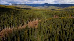
In an EO published March 1, the president directed Interior and Agriculture secretaries to issue new guidance to facilitate increased timber production on federal land, instructing agencies to remove as many barriers as possible to expedite permitting for timber harvesting. Similarly, the president has pushed for expanding timber harvesting and mineral extraction in Alaska by proposing to eliminate protections, modify land use plans, and grant permits across the Tongass National Forest and Arctic National Wildlife Refuge.
This announcement is part of a vast effort to hamstring the capacity of the Forest Service and other land-management agencies, which will likely affect their ability to enforce whatever protections are left and carry out vital work such as wildfire mitigation efforts.
This makes clear the ultimate goal of Project 2025 and this administration: diminishing the capacity of the administrative state and its agencies as much as possible, which is the third and final “bucket.”
Bucket 3: Less Agency Capacity
Under the guise of “downsizing” and “increasing efficiency” in government spending, the Trump administration has been taking a hammer to agency capacity across multiple fronts: constraining budgets and withholding grants, reducing personnel, and eliminating facilities and other resources.
This is where the impact of tech oligarch Elon Musk and his so-called Department of Government Efficiency (DOGE) is being felt most strongly. Critically, DOGE is not a department of the U.S. government but an advisory body that was given vast powers to slash regulations and cut expenditures across the government.
Under DOGE around 2,300 employees of the DOI — including 1,000 National Park Service staff members — as well as more than 3,000 employees of the Forest Service were fired unexpectedly in February. Meanwhile another 2,700 Interior Department staff reportedly resigned as a result of Musk’s resignation pressure campaign, which included a series of FAQs regarding the benefits of private sector jobs.
Recently DOGE also assumed authority to review government expenditures. For example, a recent EPA issued a guidance stating that expenses over $50,000 now require DOGE approval. As Sen. Sheldon Whitehouse (D-RI), the ranking minority member on the Environment and Public Works Committee, highlighted, this now means that a host of agency actions including routine contracts and grant awards will now face unnecessary bureaucratic delays.
This is an irony apparently lost on DOGE enthusiasts who take their mission at face value, though not to anyone familiar with Project 2025, which advocates for precisely this sort of reduction in needed government services.
Moreover, as Sen. Whitehouse wrote, allowing “unskilled, self-proclaimed experts … to have veto power over funding determinations is inappropriate and risks compromising the agency’s mission to protect public health and the environment.”
Finally, DOGE has been at the forefront of canceling leases for offices and work spaces used by employees at the National Park Service, EPA, the Fish and Wildlife Service, the Bureau of Land Management, and the U.S. Geological Survey, all of them critical for ensuring responsible land management and rule enforcement.
Now That We’ve Identified the Buckets, What Do We Do?
Although deregulation and the diminishing of agency capacity has been a hallmark of past Republican presidential administrations, the current cycle stands out for its brazenness and illegality — particularly in contrast to the Biden administration, This cycle also represents a departure from the Biden administration’s approach to public-lands management, which took conservation and restoration as explicit policy goals, at the same level as resource extraction, leasing, and grazing. This resulted in more protected lands and waters than any other in American history (a total of 674 million acres), created, expanded, and restored national monuments, and channeled an estimated $35 billion toward conservation efforts.
If we are to prevent Trump 2.0 from causing irreversible damages to the natural world, we must remain vigilant and take action. The administration’s policies have been met with public resistance and legal backlash, forcing the administration to reinstate nearly 25,000 federal employees (many of the reinstated workers, however, were immediately placed on administrative leave).
We are seeing a coordinated effort to upend the public-lands system and the role of federal agencies as we know them. It is now time to take stock, understand the Trump administration’s strategies, and develop responses that will allow us to keep swimming upstream — no matter how strong the current against us.